A diary of the 40th TGO Challenge 2019 – Part 1

The TGO Challenge is a self-supported coast-to-coast backpacking walk across Scotland. Established in 1980, it has earned a unique reputation in the UK’s long-distance walking and backpacking tradition. Over 400 backpackers apply every year from around the world, with more than 350 completing what is now considered one of the toughest challenge events in the calendar. This year is its 40th anniversary.

The first three days…

Friday 10 May
Torridon Youth Hostel to Gerry’s Bothy at Craig

We start this year’s Challenge in Torridon, a part of the west coast in the Highlands of Scotland I had never been to before. It’s stunning. The vastness of the landscape, the towering mountains and sheer beauty defy belief. I live and work in the English Lake District World Heritage Site and even though its beauty surpasses many areas of the UK, this is, quite literally, on a different scale.

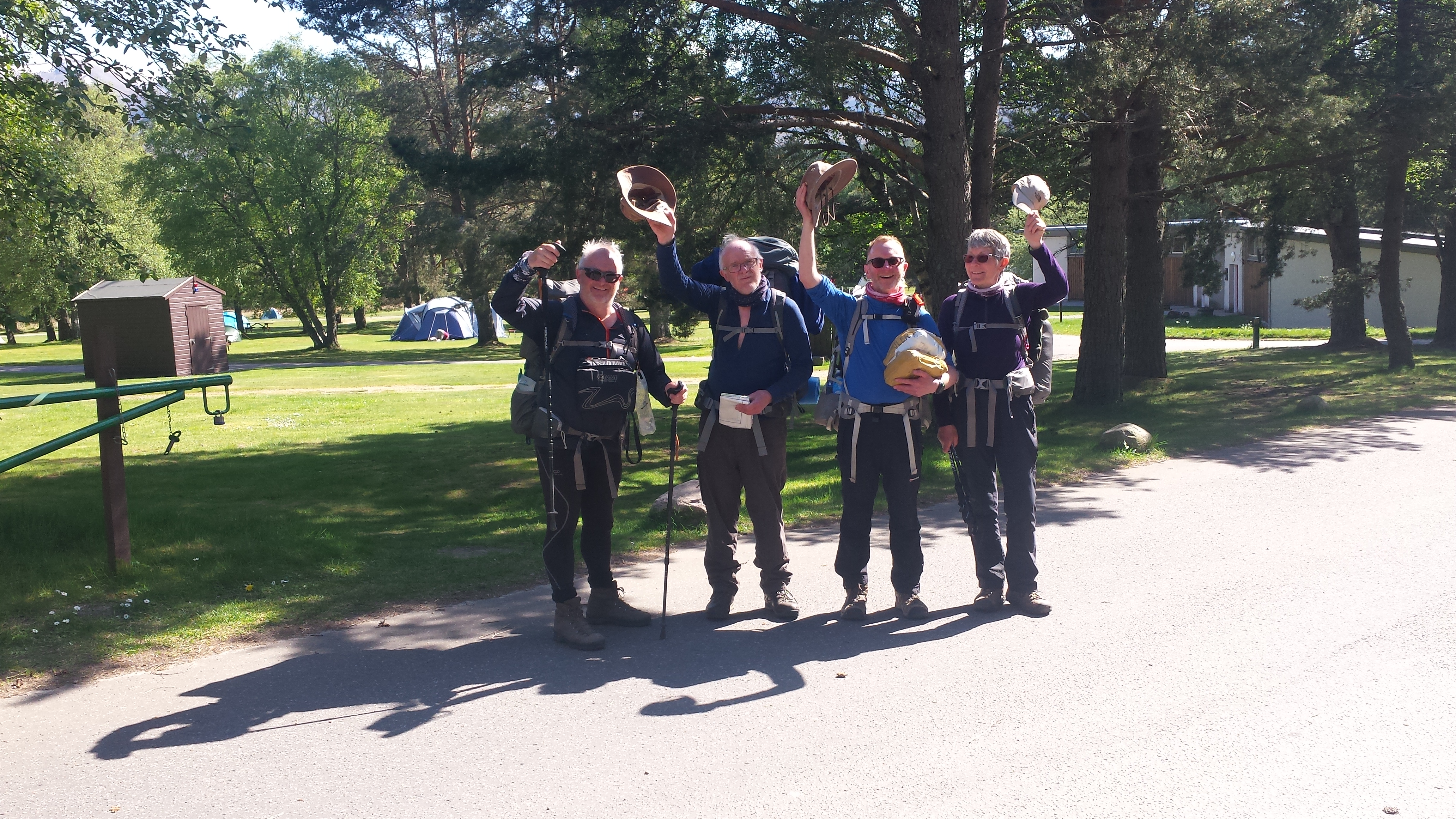
Our group of four, Tim and Heather, Dave and I, emerge somewhat bleary-eyed from the full day’s travel the day before into crisp air and sunshine. The mountain forecast posted in the hostel warns of changeable weather. Scotland’s traditional four seasons in a day looks very likely. We sign out in the usual TGO manner and, after a short walk, dip our toes in the bay and each collects a pebble to carry to the east coast at St Cyrus – our chosen finish point this year.

2019-05-10 09.18.02-1The very well appointed Torridon Youth Hostel.

59947540_10218609056074660_3703101939114835968_n (1)
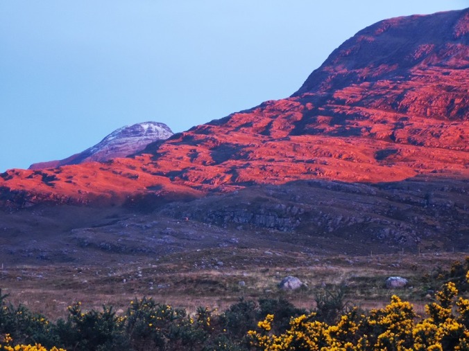
Sunset on the mountain we will be walking tomorrow.   Photo: Dave Glenn Hewitt

2019-05-10 10.19.08-1
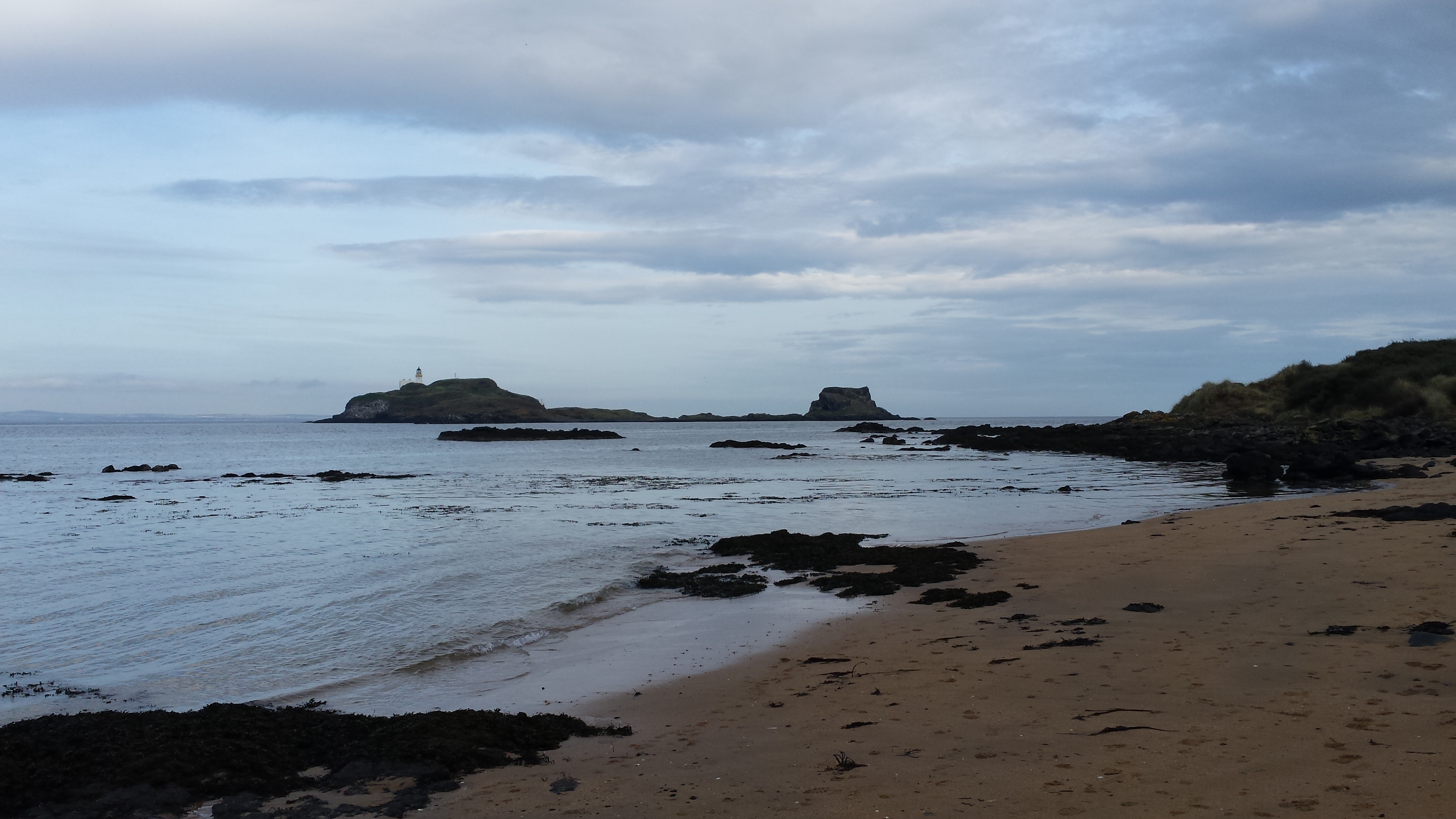
The bay at Torridon where we dip our feet and collect our pebbles.

2019-05-10 10.09.49Dave Glenn Hewitt with far too much adrenaline.

Our walk takes us south to Annat – a confusing moment for my wife, Alex, who, for the first time, is tracking me on a Garmin InReach attached to my pack. A text message received later, says: “I thought you were going east to Montrose, not south back to Cockermouth!”

The first day of any long-distance trek is usually the hardest. And it takes a few days to get hill fit. The mind is constantly playing tricks, providing you with every plausible excuse to turn back and order a taxi home. Your pack is the heaviest it will be on the whole trip with, in our case, five days’ of food and fuel to take us to our first re-supply at Auchnahillin, east of Inverness. A reassuring thought is that it will be lighter every day until that point. I try telling my legs that, but it’s not working!

I am not an ultralight backpacker by any means but I do consider myself in the lightweight category. My pack is lighter than last year at 23 pounds, or a little over 10 kilos, with 2.5 kilos of that being food and fuel. So, for those interested, that’s a base-weight of 7.5 kilos or 16 pounds. Any long-distance walker will tell you that as your body tires, your pack gets heavier. Of course, it doesn’t but your mind thinks so. However, the Silverback 55 rucksack I’m carrying this year as part of a review for the company, Gossamer Gear – kindly sent to me for that purpose – is a comfortable weight and carries really well. (Review to follow shortly.)

2019-05-08 Rucksack and ShoesGossamer Gear Silverback 55 and Altra Lone Peak 4 trail shoes ready to go.

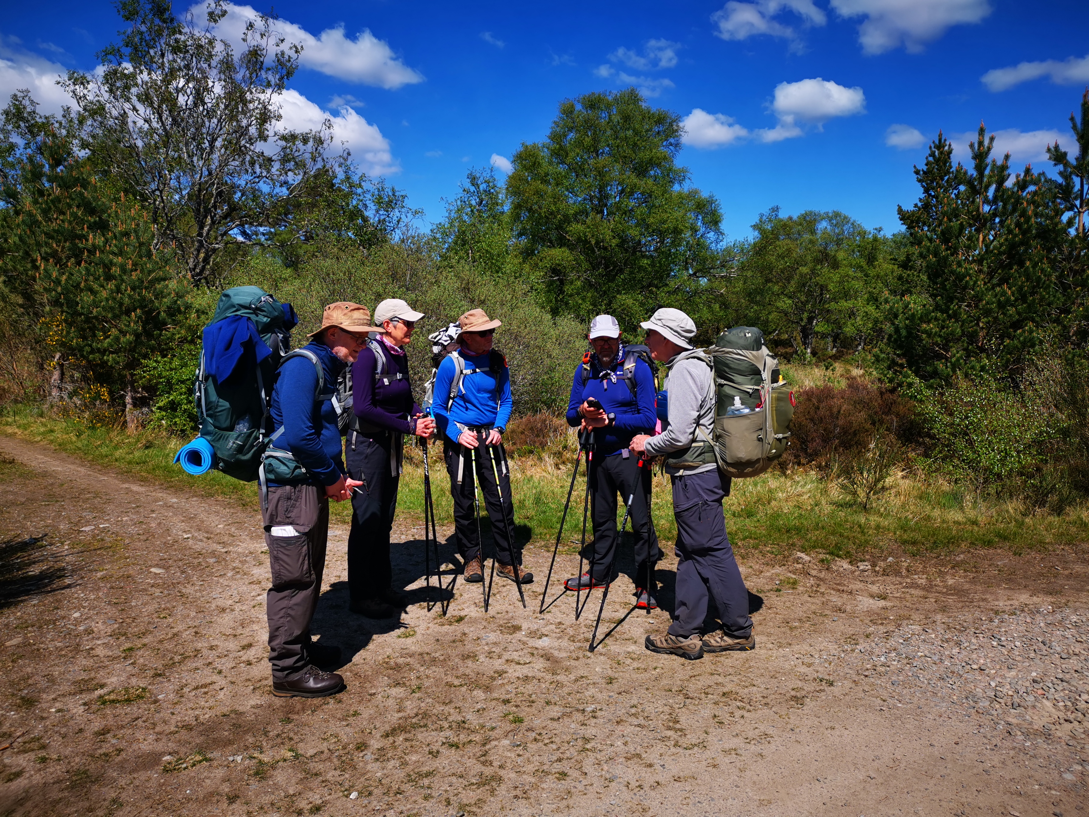
Our first climb begins after a mile or so of road walking, where we turn east (my wife will be so pleased) passing by burns and lochs on a well-trod mountain path. After a steep climb over and around the Stuc a’ Choire Ghrannda, we stop to catch our breath and, while admiring the spectacular view, we meet an Australian walking the Cape Wrath Trail who very kindly takes a photo for us. He is walking with a Belgian ultralighter who raced passed us moments earlier carrying little more than a daysack. Not sure how that partnership works but, hey, what do I know?

2019-05-10 13.56.48

60067266_10218616690945527_5212018770192629760_n

Alongside me, on the right – Dave Glenn Hewitt, Heather Jackson Brooks and Tim Jayes, with the spectacular Torridon Hills in the background.

Out first rest and brew stop comes just ahead of a sudden temperature change and a shower of sleet and snow. Perfect timing. Twenty minutes later, we pick up the climb again and within minutes are sweating in our waterproofs, as the clouds move away leaving us bathed in sunshine for the descent into the corrie to the flat valley floor. I love Scotland!

2019-05-10 15.13.48

2019-05-10 11.45.57

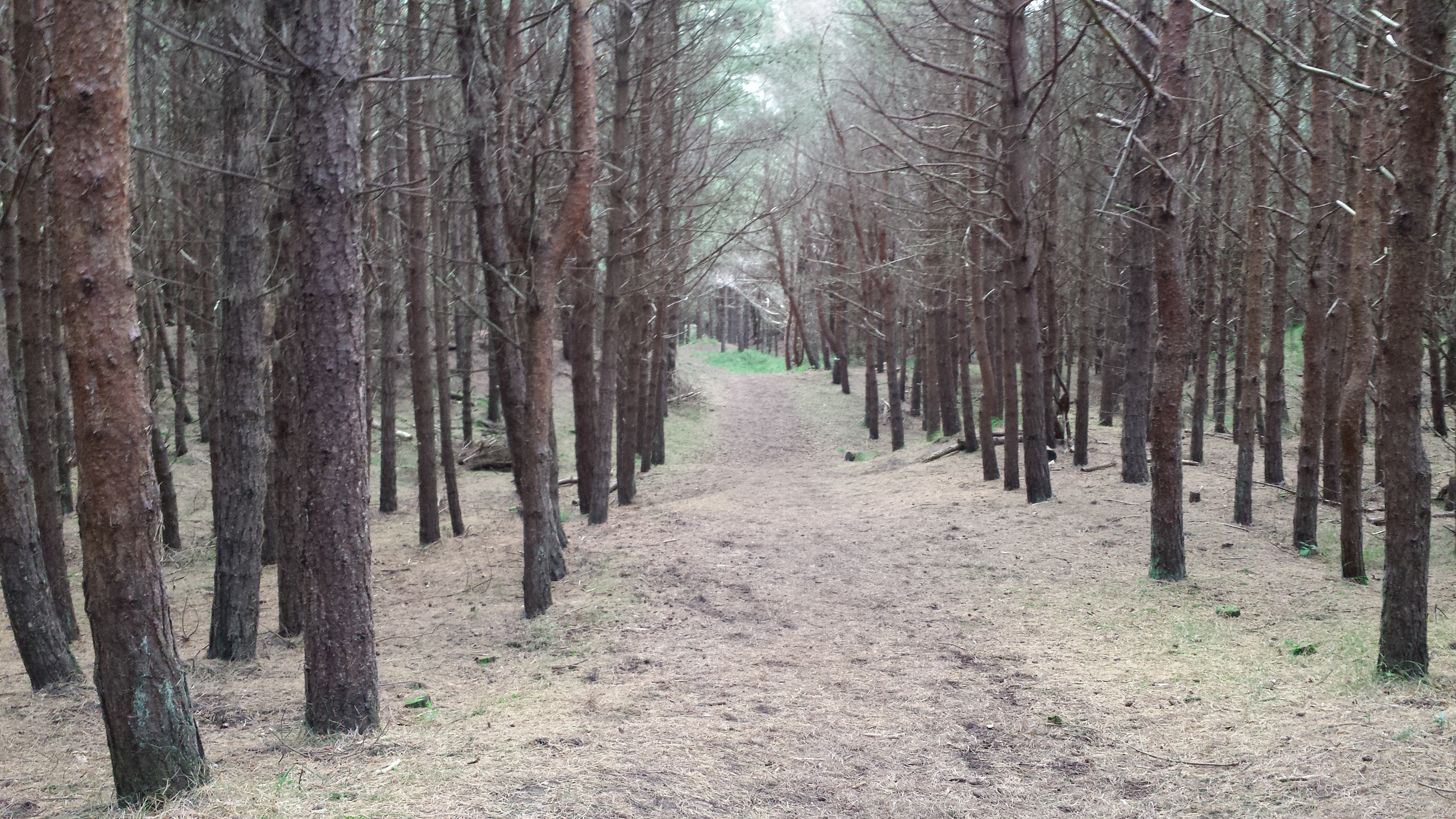
We continue down to Auchnashellach Station through the shade of a beautiful wooded area – a relief from the sunshine now on our backs – and, after some rather tedious and unavoidable road walking, we arrive at Gerry’s Bothy. There is no camping allowed now in the hostel grounds, so we decide to continue on for another 2 kilometres to pitch in the tranquillity of a forest nearby. At least the mileage will be a little shorter tomorrow.

Distance: 25km
Time: 9hrs 28mins
Total ascent: 1030m
Max elevation: 659m

Saturday 11 May
Gerry’s Bothy area to pitch near Scardroy Lodge

After a chilly night under clear skies, we wake to frost on the tents. We have all rehearsed this many times in the run-up to any long-distance section hike, but it takes a few days to organise yourself into the morning routine. Eventually, with breakfast done and bags packed, we set off, once again in beautiful sunshine with the smell of pine in our nostrils from the logging nearby.

Willie Todd, who joined us in the shared taxi from Inverness, and was pitched in the wood when we arrived, makes his farewells and peels off on his chosen route as we continue upwards once again through the Achnashellach Forest, a steady climb on a landrover track with amazing views back to the Torridon mountain range.

Along the path, we meet up with Kate Kowalska, another of the taxi companions from Inverness. Her fitness belies her age – let’s just say her bus pass is rather dog-eared.

2019-05-11 09.27.47.jpg

Hills of Torriden in the distance walking throughLogging operations and looking back to the Torridon mountains. Seems a long way now.

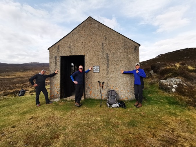
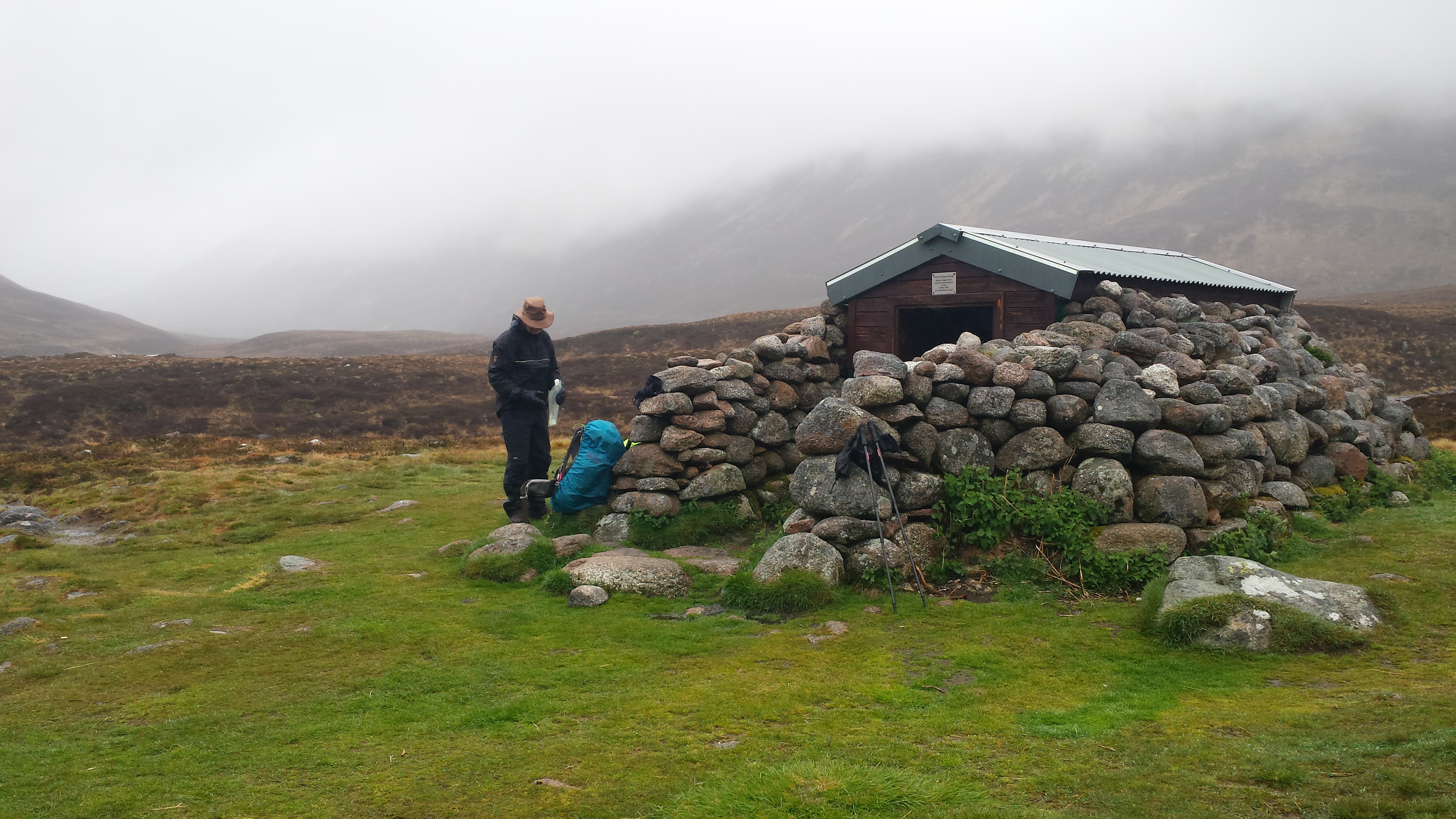
Our first stop of the day is at Glenuaig Lodge, now a holiday home, with a small shelter next to. A welcome rest stop as the intermittent showers and sunshine continue for most of the morning.

All these strategically placed huts and bothies serve to protect and shelter the traveller from the elements. In winter, the temperatures can be well below zero and, even in the corries and glens, whiteouts, driving rain and gales are common.

2019-05-11 12.00.05-1

qrf_vivid

qrf_vividGlenuaig Shelter, Scardroy. A welcome rest for us all including Kate and Heather.
Bearing information is on most huts and shelters.   
Photos 2 and 3: Dave Glenn Hewitt

Kate leaves us after about a mile, then seems to disappear without a trace. Eventually, we spot her and, reassured, continue on through Gleann Fhiodhaid following the intermittent path along the River Meig. This area requires the crossing of many fords and gullies. It’s trickier for me as this year as I am wearing Altra Lone Peak 4 trail shoes instead of boots. I will later find this was the best kit decision I ever made.

Nearing the end of our day, the house at Corrievuic comes into view as we walk the estate road. We had intended to finish a little further along at Scardroy Lodge, at the head of Loch Beannacharain, but the open grass area near the river close to the house is just too inviting – and we stop for the night.

2019-05-11 18.15.18

2019-05-11 20.42.00My Tarptent Notch, Dave’s Hilleberg Akto and Tim and Heather’s MSR Hubba Hubba

Distance: 22km
Time: 7hrs 37mins
Total ascent: 633m
Max elevation: 343m

Sunday 12 May
Scardroy to Hydro Bothy near Orrin Reservoir

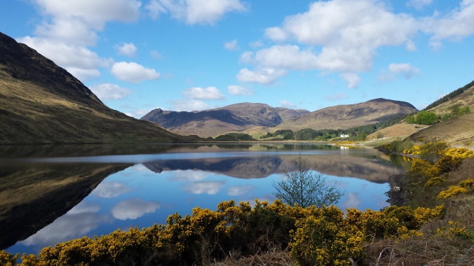
After a pleasant start through the Scardroy estate on the scenic path along Loch Beannacharain, we find ourselves on a frustrating bog-trotting trek to our eventual destination. Digital mapping is fine coupled with paper maps and compass (we always carry both) but when you arrive at the Orrin Reservoir – to find it’s gone – it can be a little confusing even for experienced walkers who know what they are doing. Apparently, the reservoir was drained some years ago, yet it’s still shown on the OS map.

Up to that point, our walk is amazing. Loch Beannacharain is beautiful. Crystal clear with fish jumping, with the mountains and clouds reflecting in its glass-like surface.
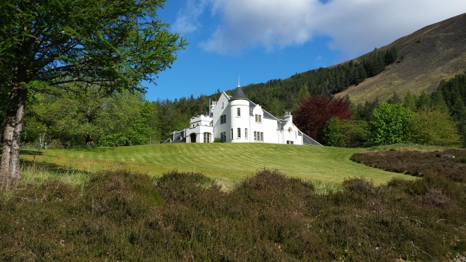
A photographer’s dream. We pass by the spectacular Scardroy Lodge with its clipped lawns and ornamental gardens, including a GPS controlled lawnmower, which we watch track up and down with amusement, at one point referring to it as ‘Knight Rider’. Further on as we climb away from the loch, we see a herd of deer watching us from afar, several stags standing proudly nearby. We spot many herds of deer and solitary stags on our journey and we soon almost felt the scenery is incomplete without them.

2019-05-12 09.54.04-1

2019-05-12 10.25.43

2019-05-12 10.25.32

2019-05-12 09.30.11-1

Today is the hottest so far. Could this be a repeat of 2018 with its nine consecutive days of crazy temperatures? We wait to find out. Just beyond Carnoch, we cross the River Mieg south to Inverchoran into the cool shade of Blarnabee Forest. However, the steep climb to the top proves worthy of our first, much needed, stop of the day.

After 4km we arrive at the bothy at Luipmaldrig, once again turning south crossing the River Orrin at the suspension footbridge to continue along the pipeline path towards the Orrin Reservoir. If you have never encountered a cable footbridge, you should know two things. First, they move up and down and side to side – all at the same time. Second, they are very narrow with just a 12-inch wooden boardwalk to step on with a sheer drop either side to the waters and rocks below. We each gingerly made our way across with videos taken to prove our skill and courage, all worthy of a certain Special Forces TV programme.

2019-05-12 15.28.39

Then it begins… From the footbridge and for what turns out to be the next 5km, the path vanishes. Our instincts tell us all to follow the south side of the river walking east to the head of the Orrin Reservoir – which incidentally, we couldn’t see at that point. Sound planning you might think. Or not? Occasionally, the path reappears for 50 metres, then disappears again. We all agree that as long as we keep bushwacking through the heather and gorse heading east, we will eventually pick up the pipeline track to our destination at the hydro bothy.

We decide to walk on the shoreline of what we think is the river. It isn’t – it was the Orrin Reservoir – which had been drained, we eventually realise, for the construction of the hydro. It is like the final scene from Planet of the Apes as we turn the corner to be greeted with a desolate landscape of white stumps of long-submerged trees, smooth boulders, dry cracked mud with the fine re-growth of vegetation. A quick look at our digital GPS mapping shows us walking through water. Surreal.

2019-05-12 18.05.36

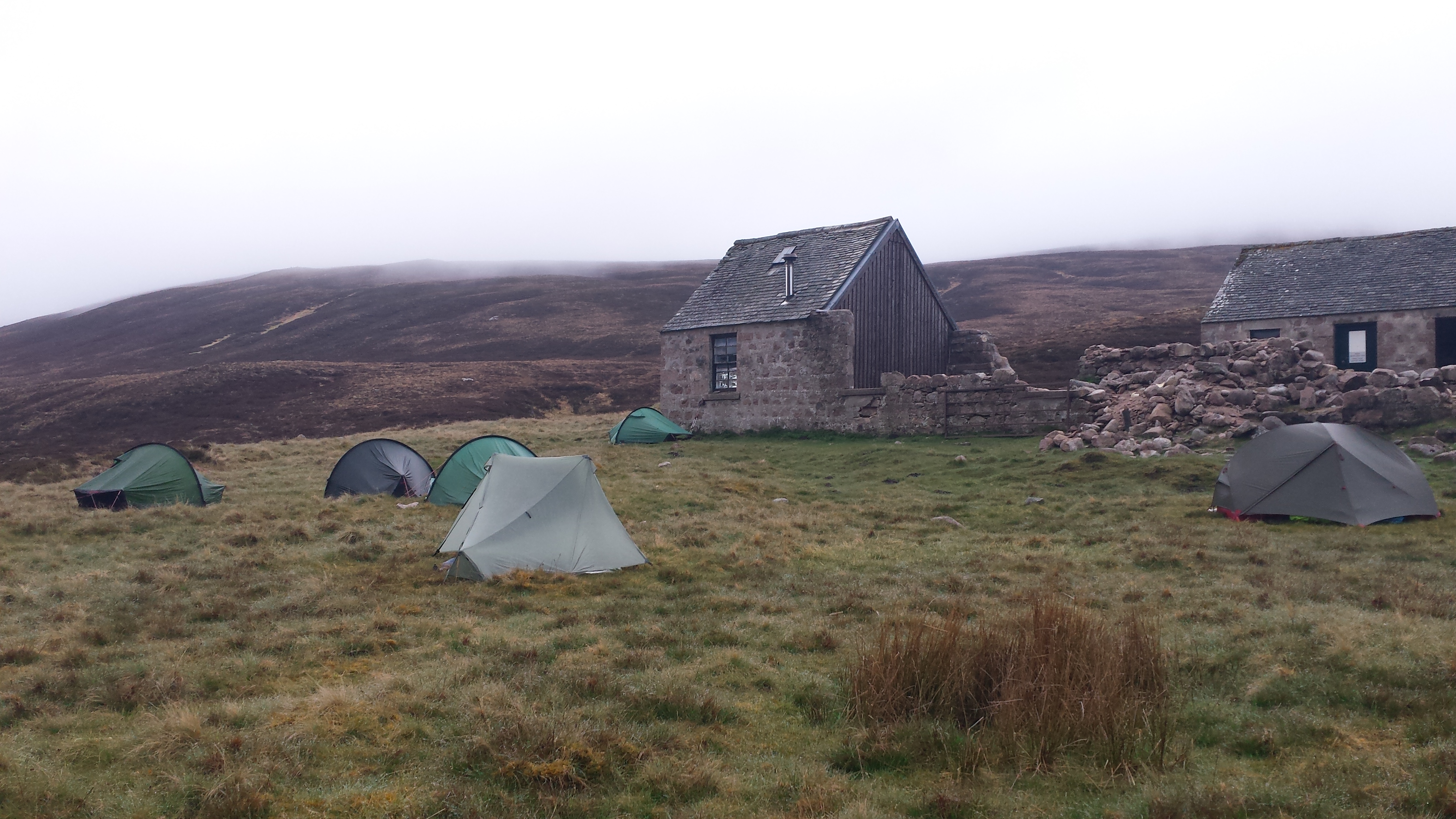
Finally, we pick up the pipeline track and head to the Hydro bothy. On arrival, quite late in the day, we are greeted by two bikepackers who arrive almost as we do and inside is Bert Hendrikse, a Dutch TGO Legend on his 19th crossing. We pitch outside, as all we care about by that time is food and sleep.

60215772_10218637613828586_6915429222425034752_n (1)

Distance: 24km
Time: 8hrs 48mins
Total ascent: 794m
Max elevation: 438m

Walk in Lady Anne’s footsteps – but mind the nettles

Lady Anne’s Way may be one of England’s less well-known long-distance walks, but it is the perfect lightweight adventure – provided you do a better job of avoiding the nettles at Nateby than the shorts-clad Mrs Lighterhiker did.

But before we get to that, a brief history lesson: Lady Anne Clifford was born into a wealthy north of England family in 1590. As a child, she was a favourite of the elderly Queen Elizabeth I. She later fought a 40-year legal battle to inherit her father’s estates, including great castles at Skipton, Pendragon, Brough, Appleby and Brougham, which he left to his brother, finally reclaiming her inheritance only after her uncle’s line died out.

Portrait of Lady Anne Clifford (1590 – 1676), Countess of Dorset, and later Countess of Pembroke, aged 28. Painted by William Larkin c.1618

The 100-mile waymarked trail, following the route she might have taken when touring her hard-won properties, starts in her birthplace of Skipton and meanders through the Yorkshire Dales and Cumbria’s Eden Valley before finishing in Penrith, making arrival and departure by bus or train a simple matter.

It is far more scenic than strenuous, especially if spread over eight days of steady but easy walking, rather than the traditional six. With its riverside paths, bridleways, minimal road walking, field margins and occasional stretches of moorland track, it is a walk best suited to lightweight approach or trail shoes rather than boots.

Wild camping isn’t really a possibility, so unless you want to use official campsites, which we didn’t, B&Bs and pub meals are the next best option. This means that, while it may not be light on the wallet, if you carry just a large daysack with spare clothes, toiletries, waterproofs and a packed lunch (known locally as a pack-up) provided by the previous night’s B&B, Lady Anne’s Way is definitely light on the shoulders and hips.

Part 1 – July 2021

Day 1 – Skipton to Hebden (14.5 miles)

Arriving in Skipton by train in the late afternoon, we treated ourselves to dinner, a room and a full English at the well-appointed Herriot’s Hotel beside the station.

Next morning, a stroll through the villages of Embsay and Eastby leads to a glorious climb over moorland and down again to the ruins of Barden Tower and the River Wharfe. The route then skirts the river most of the way to the former lead mining village of Hebden, where we were greeted at the comfortable North Barn B&B with tea and lemon drizzle cake, fluffy white bathrobes in the en-suite, and a splendid dinner.

From the town centre and on to the official start of the walk, which needed some local knowledge to find! It is very well waymarked for most of the route. Barden Tower – Lady Anne Clifford’s first castle on the route. Open moorland walking and the gold post box for the 2012 Olympic Gold medalist rower, Andrew Triggs Hodge, in Hebden.

Day 2 – Hebden to Buckden (13.5 miles)

After another huge full English, a stagger to the village of Grassington, setting for the 2020 TV series All Creatures Great and Small, is followed by a steady trek across the moor to Kettlewell, home to the WI that famously stripped off in the film Calendar Girls. From there, it is a pleasant moorland and woodland walk to Buckden, in Norman times hunting headquarters of the fabulously wealthy Percy family. We ate at the Buck Inn, where we spent the night in a smart and spacious room, setting off the next morning with some of the biggest chicken sandwiches ever seen.

A typical cobbled street in Grassington with wild flowers on every corner. Simple tracks to follow over the moors to our destination, The Buck Inn.

Day 3 – Buckden to Askrigg (11.5 miles)

Leaving Buckden through Rakes Wood, followed by a glorious climb with very few people and fabulous views, we turn onto the gated road, climbing via Hell’s Gap over Stake Moss and across the moors. Passing the Devil’s Stone and another of Lady Anne’s properties, the fortified manor house of Nappa Hall, we arrive at the picturesque Tudor market town of Askrigg, setting for the original TV series of All Creatures Great and Small.

The climb out of Buckden through Rakes Wood. The farm track taking us over the summit of Stake Moss. The view from the start of the decent with Askrigg in the distance. The fortified mansion house of Nappa Hall, east of Askrigg.

Day 4: Askrigg to Hawes and back (12 miles)

With overnight options few and far between in this area, rather than settle for a five-mile day to Hawes or an over-long trudge to Nateby or Kirkby Stephen, we opted to spend two nights in Askrigg. Staying in Milton House B&B, we enjoyed dinner both nights at the King’s Arms, which doubled for James Herriot’s local, the Drover’s Arms.

The following day, we walked an undemanding route to Hawes, one of England’s highest market towns, famous for its Wensleydale cheese and as a centre of the early Quaker movement, before heading back to Askrigg.

Milton House B&B Askrigg.

Day 5: Hawes to Kirkby Stephen (17 miles)

Milton House’s kind owner drove us back to Hawes to resume the official route where a sharp – but extremely rewarding – climb from Cotter Riggs to Cotter End soon follows. The views are superb on this lonely upland path stretch, which ends at the monumental Water Cut sculpture overlooking Mallerstrang Dale.

Passing the ruins of Lady Anne’s Pendragon Castle, we reached Nateby and the only section of overgrown path on the entire route, forcing us to wade through a section of chest-high brambles and nettles. After more than 15 miles of walking, this was too much for Mrs Lighterhiker, who trod in a concealed pothole, overbalanced and fell flat on her back, receiving nettle stings from waist to ankles. Suffice to say, she was not pleased.

Thank goodness for the lovely Old Croft House B&B in Kirkby Stephen, where she was revived by a pot of tea and a homemade chocolate éclair, followed by a soak in the bath and dinner at her favourite Indian restaurant, the Mango Tree.

With other commitments forcing us to take a break from the walk, we caught the train back to Carlisle the next morning.

The misty and rather overgrown climb from Cotter Riggs. The kilns and mine workings at the summit with amazing views from the Pennine Journey upland path, with the steam railway line and the Dandrymire viaduct in the distance. Lunch stop at the Water Cut monument designed by Mary Bourne – one of ten Eden Benchmark sculptures. The easy to miss ruins of Pendragon Castle lost in time among the trees and sheep.

Part 2 – September 2021

Day 6: Penrith to Temple Sowerby (12.5 miles)

Restarting some six weeks later from Penrith station, a pleasant wander took us past the ruins of Brougham Castle before going slightly off route to find accommodation in Temple Sowerby, named after the crusading Knights Templar. We ate at the King’s Arms (Yes, different one!) and treated ourselves to a night at the costly House at Temple Sowerby B&B, where a very mean cooked breakfast and no subsequent offer of toast and marmalade or a second cup of coffee left us wishing we had saved our cash and stayed at the King’s Arms. Sadly, even with the host’s guided tour of the facilities and garden and en-suite jacuzzi bath and the beautifully wrapped pack-up lunch, the experience felt more style over substance.

The bandstand in Penrith Casle Park – starting in reverse this time – our departure for the second half of Lady Anne’s Way. Brougham Castle in all its splendour.

Day 7: Temple Sowerby to Sandford (14 miles)

We picked up the route at Kirkby Thore, which boasts a medieval hall and the site of a Roman fort, before heading for Appleby. Home of the annual horse fair, Lady Anne is buried there, in the parish church of St Lawrence, near yet another of her castles.

From Appleby, the route follows the River Eden to Sandford, where we went off route again for dinner and B&B at the excellent Sandford Arms. The warm welcome, generous breakfast and eccentric but delicious pork-three-ways pack-up (ham sandwiches, pork pie and cold sausages) only reinforced our annoyance over the cost of the previous night.

The Grade II Forester’s Hall Reading Room in Kirkby Thore. Built in 1832 as a single story reading room with the second floor added in 1884 to house Forester’s Lodge No 884. The Forester’s Deer’s Head motif can be seen above the top plaque.

The Parish church of St Michaels in Appleby. It’s unfortunate that our chosen route detoured away from her castle and the parish church of St Lawrence where Lady Anne is buried. Our stay for the night, the Sandford Arms.

Day 8: Sandford to Kirkby Stephen (12 miles)

The walk through the lovely village of Warcop was punctuated by booms, crumps and rattling machine-gun fire from the nearby MoD training area. Passing the ruins of Brough Castle, we soon found ourselves back in Kirkby Stephen. This time we stayed at the fabulous Lockholme B&B and, after tea and homemade chocolate cake, enjoyed a final dinner at the Mango Tree.

Hidden pathways walking to Warcop and, in the distance, the impressive Warcop Hall. Walking this part of the route in reverse it was always advisable to turn and check for the markers on fence posts. These very inquisitive cows followed us across a field right to the gate and didn’t seem to want to let us out. Brough Castle en-route to Kirkby Stephen.

We boarded the train for home the next morning with lighter wallets, much tighter waistbands but with a spring in our step.

Walk this route and there is every chance you will too – provided you make it through the nettles at Nateby!

The truth about the West Highland Way… and how to make it perfect

By Mrs Lighterhiker

If I never see Loch Lomond again, it’ll be too soon. Lighterhiker and I may live in England, but I’m a Scot, so I’m allowed to say that. I’ve read that the West Highland Way is traditionally walked from south to north to prepare the legs for the more demanding second half, but it’s actually best done that way so the northern portion acts as a reward for enduring the southern part.

We should have been on the TGO Challenge (the two-week Great Outdoors unsupported cross-Scotland walk) this month, Lighterhiker’s third and my first experience of the event. But when it was pushed back to June, we decided to give the midges a miss and postpone for another year. The West Highland Way was our substitute – and in most aspects, it didn’t disappoint.

Walked over eight days, at 155km (96 miles) and around 3,000m of ascent on clear paths, it’s a relatively leisurely endeavour. The route is so well marked, you don’t even need a map (although you should always carry one anyway) and there are plenty of places to camp and get food.

We leave from Penrith station and arrive at the start in Milngavie, on the outskirts of Glasgow.

Dummy white heading for spacin

Days to forget

Day one was an afternoon wander from Milngavie, via Mugdock Country Park and the legendary Carbeth huts, to Drymen Camping, a mile south of Drymen itself. Our first mistake was eating a late lunch on day two at the Oak Tree in Balmaha. Unless you like bone-dry, tasteless burgers, greasy fish and vastly over-salted chips, it’s best avoided.

Carbeth Huts started as a camp ground for returning First World War soldiers. During WWII, the huts were filled with evacuees and families who had lost their homes in the Clydebank blitz. Today, they house an off-grid community of Glaswegians looking to reconnect with nature.

Second mistake of the day was walking only 14.5km (nine miles) to the Milarrochy Bay Camping & Caravanning Club site, where we’d booked a pitch. It turned out one of the couples running it is from our (very small) Lake District town and we have mutual friends, so it was worth the visit.

However, we were soon wishing we’d gone further to get more of the rocky, roller-coaster, root-knotted, litter strewn shore of Loch Lomond out of the way. The narrow, trip-hazard path, and constant soundtrack of traffic from the A82 and jet skis and power boats on the loch itself, made for a grim 32km (20 miles) spread across days two to four.

We wild camped on the third night about a mile south of Inversnaid at what looked a lovely waterside spot. Closer examination revealed our grassy knoll and the neighbouring stretch of beach were a mess of broken glass, empty beer and baked bean cans and other less pleasant refuse.

Having seen the damage certain people are wreaking on the environment, the move to regulated camping along parts of the shore now makes sense, although it clearly isn’t stopping littering outside these zones.

Our first wild pitch on the loch side outside the Camping Management Zone. It was upsetting to see the amount of rubbish left on the beach and around the site. Some may have washed ashore but most was clearly left by people who couldn’t care less.

It took until lunchtime of day four to get to the end of the loch – and it wasn’t a moment too soon. After that, both path and surroundings took a distinct upward turn. We walked on, via a second lunch-cum-early tea at Beinglas Farm, veering temporarily away from the A82, to wild camp at the edge of the forest where a path splits off to link with Crianlarich (What3Words: fillings.announce.bunkers).

A beautiful, sunny evening pitch on the edge of the forest, near Crainlarich, was followed by a great night’s sleep.

Dummy white heading for spacing

Days to remember

Day five started with a lovely woodland walk, followed by a visit to bikers’ favourite the Green Welly Stop in Tyndrum for hot sausage rolls, freshly baked scones and decent coffee, before we headed on to Inveroran and a night in Maurice Cassidy’s quirky wooden cottage.

A moment’s rest beneath a railway bridge, just north of Tyndrum, and a fascinating graveyard by the remains of
St. Fillian’s Priory. Maurice Cassidy’s wooden cottage is over 100 years old.

The real West Highland Way runs from here, at 100kms (62 miles), to its conclusion in Fort William. With the main road largely left behind, there’s nothing to disturb the peace and breath-taking views as you cross Rannoch Moor to Kings House Hotel by Glencoe.

The view looking east, from Ba Bridge, across Rannoch Moor.

The Kings House Hotel, Glencoe. Our pitch was just to the left of the bridge, on the river bank.

We camped beside the hotel, which has free pitches and good showers and toilets for campers, and, fuelled by a breakfast of proper coffee and bacon rolls, set off for the Devil’s Staircase. Despite the name, the climb didn’t feel as bad as the one that followed out of Kinlochleven, leading to our final wild camp at a burn-side spot (What3Words: alongside.machine.beads) on the Lairigmor Pass.

The beautiful and dramatic Glencoe, complete with rainbow – a sign of a wet day ahead.

The rock cairn at summit of the Devil’s Staircase is the highest point of the West Highland Way, at 550m. The descent follows a long but scenic path to Kinlochleven.

Our final pitch on in the stunning Lairigmor Pass. A shrouded Ben Nevis in the background.

The last day’s walking, past snow-capped Ben Nevis, into Fort William was another belter – quiet, isolated and over too soon – although we were tired by the time we arrived at the town’s Premier Inn. We celebrated with dinner at the excellent Crannog fish restaurant. If you want to do the same, make sure you book – it’s very popular.

Next morning, after breakfast at Costa and buying a majestic packed lunch from Rain Bakery, we took our seats on a near-empty train south and reflected on our journey.

Sitting next to ‘Man with sore feet’, a bronze statue by David Annand placed here in 2010 to mark the ‘new’ end of the West Highland Way. The original finish point is still marked just on the edge of the Fort William.

Dummy white heading for spacing

What we learned

If you enjoy spotting wild flowers and wildlife, from cuckoos and woodpeckers to frogs, stags and feral spikey-horned sheep, the West Highland Way is a fabulous walk – provided you can put up with the litter and traffic noise on the less than bonny banks of Loch Lomond.

We were shocked to realise that many people, most young enough to be our children or even grandchildren, carry only wee day sacks, handing over the bulk of their luggage to Sherpa vans and staying at campsites or B&Bs.

At 9.5kg each, including consumables, our packs were no bother. The Gossamer Gear rucksacks, Trekkertent Drift 2, custom made Cumulus sleeping bags, Sea to Summit mats and shoes we took – Topo Athletic Ultraventure (Lighterhiker) and Lone Peak Altra 4.5 (me) – were ideal for the route and mixed weather.

The decision to carry just four days of food supplemented with meals bought along the way worked well. The homemade muesli bagged with whole milk powder, oatcakes, Primula squeezy cheese, Aldi cereal bars, dried mango, trail mix, and dehydrated meals we carried weighed just under 2.5kg each.

Dummy white heading for spacing

The perfect approach

Despite the traffic, trash and lakeshore trudge, the West Highland Way is well worth doing. But if we tackled it again, there’s one big thing we’d do differently – and, if you’re not hung up on bagging the complete route, you might consider doing the same.

To make the West Highland Way truly perfect, take the train or ferry to Ardlui at the top of Loch Lomond, start there and spend five days enjoying 92kms (57 miles) of proper peace and glorious walking.

Alex Morgan, aka Mrs Lighterhiker, is a journalist and award-winning novelist.

A diary of the 40th TGO Challenge 2019 – Part 4

The TGO Challenge is a self-supported coast-to-coast backpacking walk across Scotland. Established by mountaineer and writer Hamish Brown and Roger Smith, then editor of The Great Outdoors magazine, in 1979, the first event took place in 1980. It has earned a unique reputation in the UK’s long-distance walking and backpacking tradition.
Over 400 backpackers apply every year from around the world, with more than 350 completing what is now considered one of the most unique challenge events in the walking calendar. This year is its 40th anniversary.

The last five days…

Sunday 19 May 2019
Faindouran Lodge to Corndavon Lodge

From the torrential rain of yesterday, we wake to sunshine, which almost immediately disappears behind fluffy clouds. Despite the previous wet day, most of our kit hanging in the makeshift drying room in an outbuilding of Faindouran Lodge is dry. My trail shoes – well, that’s another story.

Today’s section is a fairly climb-free day, following the contour along the meandering Glen Avon, then south following the Builg burn to our destination at Corndavon Lodge. For the most part, the landrover track leaving Faindouran is a pleasant change from the bitter winds, bog-trotting and puddle-guddling of yesterday, with gentle gradients and descents coupled with the menacing sounds of the River Avon in spate to our right. The scenery just gets better and more spectacular. The rush of water in the river in some places is deafening. It’s all that can be heard in the otherwise silent and dramatic splendour that is Glen Avon.

Still a little chilly but the landrover track is much easier on the feet and the legs

Following the River Avon into the glen, we pass a small shelter hut that seems to be locked – a shame should we have needed it. Eventually, we reach a footbridge and, crossing to the other bank of the Avon, arrive a little later at the thundering waterfalls in the Linn of Avon. 

Glen Avon is a conservation area with many trees planted from native seeds, collected from the glen in a recent initiative by The Forestry Commission supported by Glenavon Estates. Since the red deer have been excluded from the area, the foliage, ground heather and tree regeneration are encouraging wildlife to return. It will be interesting to see the results in a couple of years.

We arrive at the bridge, which is our junction to turn south, where we stop for lunch – well, oatcakes, tea and Hobnobs. Boots and shoes and socks off to air the feet – and, in my case, a change from waterproof back to wool outer socks. As any long-distance walker will tell you, there is no better feeling than cosy feet in dry socks. We move on after a half-hour stay, this time to take the path along Glen Builg, following the burn to the Loch.

Hobnobs and dry feet – a perfect combination

The path along the edge of Loch Builg is damp, to say the least, as we weave in and out of the mud and puddles. The area is still spectacular and even more dramatic, and at the south end of the loch over in the distance, the ruins of Lochbuilg Lodge stand as a sad reminder of good times past. As we turn east, following the River Gairn, in the distance looms Corndavon Lodge – a welcome sight for our overnight stop. 

We find several people pitched already, including the German couple, who we seem to have leapfrogged since meeting in Nethy Bridge at the Lazy Duck campsite, and a couple who we met in the Fords of Avon Refuge yesterday. After about half an hour, we are greeted by the soon to be ‘legend’* that is Laura Liddle, on her tenth crossing, recognised, even from a distance, by her trademark purple (her clothing, not her face!). Great to meet up and to admire her Japanese tipi shelter which she raves about. For some reason, I find myself nicknamed ‘Trevor Two Doors’ because of my argument that two doors and vestibules are better than one on a trip like this while pointing to my Tarptent Notch. An argument I don’t win of course.

*A TGO Legend is one who completes 10 or more crossings.

Distance: 22.2km
Time: 6hrs 42mins
Total ascent: 710m
Max elevation: 596m

DUMMY HEAD

Monday 20 May 2019
Corndavon Lodge to Ballater

We wake to a perfect morning, clear blue sky and crisp fresh air. With no condensation on the tent, a leisurely pack up and, for the first time, I even beat Dave, who is always the first ready for the off.

Laura Liddle left just before us, so off we go following the snaking River Gairn, crossing the small bridge just before Daldownie and on towards Garnshiel Lodge. The river path is a glorious walk passing through Renatton, re-crossing the river to Tullochmacarrick, and skirting the base of the majestic 657m Craig of Tulloch. After a brief road walk, we pick up the track to pass through the farm at Tomnavey. When this runs out, we pick our way across several rather soggy fields to the footbridge, just before Balno and, emerging from the trees onto the road, turn left into Glen Gairn, following the river path once again to head for Ballater and our campsite for the night. 

Ballater is a wonderfully traditional town. Its Old Royal Ballater station dates from the 1866 and was closed by Beeching in 1966, reopening much later, only to be destroyed by fire in 2015. In August 2018, after a massive refurbishment, it reopened as the town’s tourist information centre and museum, reflecting the station’s links with Royalty, particularly with Queen Victoria, including her own private waiting room and commode toilet.

On the main street, we decide to stock up on a couple of items in the local outdoor shop and realise the adjoining building is a cafe. Never ones to pass up food, we take our seats in The Bothy. What was intended to be a coffee and sticky bun turns out to be three courses for me, which saves me heating up yet another foil meal in the evening. A good decision as when we emerge, the rain is starting again.

Most of the day it has rained on and off and it starts again as we find our pitches. Torrential rain follows briefly confining us all to our tents. Finally, it stops and we prepare for the evening’s well-earned rest. The shower block at this camping and caravan park is splendid, providing you can remember the code to get in. It has to be said, never was a hot shower more welcome. That evening we head back into Ballater to a welcoming pub for crisps and beer to recharge not only ourselves but our devices too! At 11pm the rain starts yet again and continues until 6am. 

Ballater campsite

Distance: 21.7km
Time: 6hrs 6mins
Total ascent: 441m
Max elevation: 414m

DUMMY HEAD

Tuesday 21 May 2019 
Ballater to Tarfside

Rain – it’s part of Scotland – or so it appears. It is, however, equally true of the Lake District where I hail from, so you would think I’d be used to it. Not really!

The campsite at Ballater has seating and eating shelters dotted around. Once showered and dressed, most of the Challengers in our corner of the field are crammed into one in case it rains again. We were all able to pack, chat and eat in the dry before heading off on the long day ahead – our destination, the Challenge tradition that is Tarfside.

Sheltered picnic tables on the campsite

Fortunately, even if a little humid, the day is warm and bright. There are some black and heavy clouds in the distance but not in our direction of travel at the moment. Today we head for Mount Keen or, at least, the plan is to take the lower path around its shoulder en route to the Tarfside. Most Challengers planning their routes opt to converge here before setting off on the penultimate stage to North Water Bridge. It’s a great opportunity to catch up and take advantage of the BBQ and beers provided by the Masonic Lodge or a pre-booked evening meal at St. Drostan’s, staffed by the wonderful TGO volunteers, who work tirelessly over three days supplying full meals, tea and cake to hungry walkers.

We head out of Ballater over the road bridge, named The Royal Bridge after it’s opening by Queen Victoria in 1885, turning right onto the road to the junction at Bridge of Muick. Here we leave the road, crossing open fields and into the forest to start the gentle climb towards Mount Keen, which can be seen towering in the distance. However, some boggy pathways across the heather moors – some of which have a nasty habit of disappearing into the undergrowth – have to be encountered first. Fortunately, there are still some old marker posts here and there indicating the route. At 560m we start bog-trotting the tricky descent on the Mounth Road path, passing several grouse butts into Coriebhruach to the landrover track at the foot of the path to Mount Keen, which looms in front of us. Here we pause for a break. 

Here we meet up once again with the German couple we first encountered at The Lazy Duck campsite and take the opportunity for a group photo and, afterwards, to peel off our rain gear for the climb ahead.

The very well constructed path ahead is in the process of repair by the National Trust for Scotland, and a fine job the Footpath Rangers are doing too. Even and consistent steps are a blessing when you’re tired and, in my case, a little older than your walking companions. We finally arrive at the junction to either climb up to the cairn (939m) or along and down the shoulder path, and a knee-wrenching descent to Glen Mark. 

Well, mad or not, we choose the cairn and aren’t we glad we did. The new path has not been completed so we have to tread carefully when it runs out. Near the top, with the cairn in sight, the landscape changes to a moonscape, which I can only liken to the boulder field on Scafell Pike in the Lake District. Tim and Heather arrive first, to find our German friends sheltering from the wind, followed by me and David. A triumph and much back-slapping later we settle down to admire the amazing 360-degree vista. 

Then a rainbow appears, followed by another, as if they have been waiting for the audience to be seated before the show begins. Never have I seen such clear colours in a rainbow before – spectacular. There is a reason for a rainbow – it usually indicates rain – a lot of rain!

We descend to the flatter ground of Glen Mark, passing the famous Queen’s Well, following the Water of Mark on our right. Looking behind, we see the reason for the rainbow. It is the darkest cloud I have ever seen, as if someone has turned the lights out as we are walking and very similar to the ones now appearing in front of us. Fortunately, all of us have the presence of mind to stop and hurridly don our waterproofs and not a moment too soon. Blatter doesn’t cover it. It is the kind of torrential rain that hurts your face and anything else it touches. We eventually have to take shelter under the canopy of trees just before House of Mark, until it finally stops and the sunshine returns as if nothing has happened.

Joining the road, and walking the short distance to the gate, takes us along the Invermark Path, crossing open fields, passing the Hill of Rowan and its monument on our right. After what seems like an eternity, we arrive at St Drostan’s Hostel and Tarfside. It has been a long day and as we arrive later than planned, sadly, there is no food left in the hostel. So, onto the village green, to find our pitch among the other 50 or so tents. We decided to pool our food for the evening, swapping our various foil meals. I even manage to buy some beers and cider from the Masonic Lodge, which go down very well indeed.

Distance: 28 km
Time: 9hrs
Total ascent: 1125m
Max elevation: 934m

DUMMY HEAD

Wednesday 22 May 2019 
Tarfside to North Water Bridge

We have been upgraded! What? You may ask. Breakfast, as we turn up late yet again for our food, is only supposed to be a bacon roll. However, we are told by those nice volunteers at St. Drostan’s, with a gentle tap on the side of the nose, to sit at the table. Eventually, a full Scottish breakfast is placed in front of us, much to our surprise and delight, with the immortal words “you’ve been upgraded – you look like you need it!”

Sad to feel this challenge is coming to an end. A feeling I imagine, and for differing reasons, most TGO participants experience about now. Today’s section is mostly flat, a welcome relief from the toils of yesterday. However, road walking can be just as taxing on the limbs, and feet particularly, when carrying a pack. Our route is well-trodden, a straightforward push to the Challenger hub of North Water Bridge campsite via the now-closed Glenesk Retreat and Folk Museum, which when not under pressure, used to serve amazing breakfasts for hungover Challengers.

Opting not to queue for the public and very oversubscribed toilets in Tarfside, we set off on the road east. It’s a gentle climb with beautiful scenery on either side. The rural landscape is changing as we leave the Cairngorms National Park behind us, although in what way is hard to describe – it’s just a sense. There are more Challengers on the road now – probably more than we have seen in two weeks, all heading for their chosen finishing destinations.

Leaving the road and now on soft fields and farm tracks, we move along next to the River North Esk, past the Dalhastnie iron footbridge, still closed for repair from last year. David is still cracking jokes as he has done for the whole trip. He seems to sense those times when we all need a lift in spirits. Laughter is good medicine. At a brew stop, we watch in admiration as a young farmer on a quad with his three dogs standing, perfectly balanced, like circus performers, on the wheel arches of the bike, herds his sheep along the edge of the field. He even has time to wave to us. 

Refreshed, we stand with some effort and continue towards The Rocks of Solitude on our left. The name is given to a set of dramatic waterfalls in a gorge on the North Esk. Some Challengers prefer to follow its path above and along the gorge and, in spate, some parts are spectacular, to say the least. It forms part of what is locally known as ‘The Blue Door River Walk’ where, travelling east as we do, you come to a blue door in a wall that opens onto a bridge crossing the B966. This is actually the beginning of the riverwalk going west and I’m told it’s like stepping through the wardrobe door into Narnia. This year the door and the walk are closed due to a landslip. One year I will add it to my route.

On to Dalbog, and taking the shortcut across the fields past the beautiful conical-shaped reservoir pump house, we finally join the road into Edzell, passing the early-bird revellers outside the Panmure Arm and onto The Tuck Inn, where Dave and I each consume a very large plateful of battered cod and chips. Apparently, the management has changed from last year, and some feel it’s a different atmosphere and perhaps not as friendly. Times change but the fish and chips are still spot-on, as is the ice cream! 

The conical-shaped reservoir pump house

Now to the final leg of the day and onto the campsite. Leaving by the lane next to the Post Office, we cross the North Esk again over ‘Shakey Bridge’. This leg has the reputation of being hard on the feet. Solid road walking now, with a three-mile, arrow-straight stretch past the now-disused RAF Edzell. A bit of a monotonous yomp with no pathway, it can sometimes be a little hairy with the traffic. It never seems to end. 

Eventually, we reach the packed campsite to the greetings of our fellow Challengers. It feels emotional, as if the last day with only a short push to the coast, is almost irrelevant. It won’t be and the emotion has only just begun!

North Water Bridge campsite – our last pitch of the challenge

Distance: 28.4km
Time: 7hrs 51mins
Total ascent: 479m
Max elevation: 216m

DUMMY HEAD

The Final Day – Thursday 23 May 2019
North Water Bridge to St. Cyrus

Waving goodbye to others who have selected different destinations to finish this amazing adventure, we leave North Water Bridge, crossing the fast and furious A90 to the tranquil lanes en route to St. Cyrus – this year’s chosen finish point. 

It is a pure, all-day road walk, which, for once, is not a daunting as it sounds, partly due to the euphoria and emotion of the last day. A jovial start soon slips into long periods of contemplative silence. Our route takes us through the Den of Morphie, which sounds straight out of Lord of the Rings. We pass through farmland and fields, with the overpowering and heady fragrance of rapeseed billowing in the wind as St. Cyrus and the North Sea come into view. 

Emotion is a strange thing. On the train coming into Inverness, several old-time Challengers had said, “You’ll cry – we all do!” Nah! Not me! Well, I did in 2018 – uncontrollably, when Ali Ogden handed me my certificate in the Park Hotel at Montrose. I thought that was a one-off. It wasn’t, and I feel myself beginning to well up. Past the church at St. Cyrus, we reach the steps down to the beach. Many steps, in fact, almost like a final test of willpower over aching limbs. There, in front of us, is the North Sea. As we walk across the vast sands to the water’s edge – yes – I think it’s fair to say we shed a few tears.

There is a tradition of each carrying a pebble from one shore to the other. These are then ceremoniously thrown into the surf. Then, names and messages are carved into the sand and photographed for posterity. Heading back up 105 steps we came down earlier (yes, I counted them!) we head for the nearest pub to celebrate. Several pints, snacks and much laughter later, the publican appears and very kindly offers to drive us to the Park Hotel in Montrose, as she is going that way. A welcome end to a fabulous day’s walking.

On arrival at the hotel entrance, many Challengers are outside and the foyer and bar are packed. We arrive to handshakes, hugs and slaps on the back, seeing familiar faces from past events and those we have met on the journey. The Park Hotel is closed to residents for three days. It’s full of Challengers – all 350 of them. It’s been that way for some years. I suspect the staff dread these three days, particularly the bar staff. The Kinnaird room (Challenge Control) on the first floor is set aside for signing out on completion, the collecting of certificates and goodie bags and a very welcome hot drink and many biscuits. It again proves to be an emotional experience, particularly for David, as he had to abort a previous crossing attempt through injury. 

We all collect out 40th anniversary certificates from the man who started it all in 1979 – Hamish Brown

We return to the Park Hotel in the evening for the main celebration dinner. It’s a wonderful affair, brilliantly orchestrated by the staff with flawless presentation. Seating is shoulder to shoulder and the atmosphere is priceless. Throughout the meal, there are toasts to many, and presentations for those Challengers who have completed their 10th or 20th crossing. These people are given the title of TGO Legends. However, the most important toast is the to first-time Challengers, given in comic style by Russ, a 16-year legend. All first-timers are asked to stand and are given rapturous applause, which seems to go on for ages. There are many tears from those standing. This also, as I found out on my first crossing, is a significant gesture. “You are now part of the TGO Family”. A wonderful family it is too and long may it continue. 

Tim, Heather and David were a great team to cross with and were fabulous company. It was Heather’s first and David’s first completed crossing, and not their last, I’m sure. Thanks, guys. 

Distance: 14.4km
Time: 4hrs 8mins
Total ascent: 335m
Max elevation: 123m

All images in this post: Copyright David Glen Hewitt and Trevor Morgan 2019

DUMMY HEAD

Footnote

The last part of this blog, covering the final 5 days, was, for various reasons, written in May 2021. What no Challenger could know back then is that the 2020 TGO Challenge would be cancelled – only the second time in its 40-year history – due to the Coronavirus pandemic. This year’s TGO 2021 Challenge is still going ahead but has been moved to June to take advantage of the easing of lockdown restrictions. 

It should also be remembered that this event would not be possible without the tireless efforts of the coordinators, Sue Oxley and Ali Ogden, and the brilliant volunteers, sponsors and suppliers who unselfishly commit to this event every year.

My wife Alex and I had planned our first joint TGO crossing in 2020, transferring our places to 2021. We deferred again this year, choosing not to travel to Scotland in mid-June to avoid the midge! (I’m married to a Scot who knows about this stuff!) Hopefully, the whole TGO family will get together again in May 2022, for which we have our place already secured. In May 2021, we completed The West Highland Way in a leisurely eight days, partly compensating for missing this year’s Challenge. It was a fabulous walk. The blog is written and will be posted soon. We hope you enjoy it. 

A diary of the 40th TGO Challenge 2019 – Part 3

The TGO Challenge is a self-supported coast-to-coast backpacking walk across Scotland. Established in 1980, it has earned a unique reputation in the UK’s long-distance walking and backpacking tradition. Over 400 backpackers apply every year from around the world, with more than 350 completing what is now considered one of the toughest challenge events in the calendar. This year is its 40th anniversary.

Days 7 to 9


Thursday 16 May
Insharn to Nethy Bridge

This has been the best night’s sleep so far, so much so, that I nearly miss breakfast. Collapsing into my bag at 9.30pm and waking at 7.30am – 10 hours – that’s a very good sleep indeed.

img_20190516_080604-e1563975226143.jpgEmerging from the long sleep, woken only by the sunshine.

Today, we continue to Nethy Bridge and the Lazy Duck Campsite. Andy, who joined us last night, has a pitch already booked. The question is whether we can pitch too. We were told before we started that the campsite was almost fully booked with one place left, so we resigned ourselves to wild camping nearby. Hopefully, the unwritten rule of not turning a backpacker away will still apply.

To start our day, we head back through the farm, disturbing the dogs yet again, to pick up General Wade’s military road. Most of the morning we will be in forests and on landrover tracks, much to the relief of some of our group’s feet, which are starting to show blisters – yesterday’s road walking taking its toll. I’m feeling quite smug at this point. My choice of Altra trail shoes has, so far, proved the right one. Not even a hotspot, let alone a blister.

The trail shoe debate will, no doubt, run forever. (Excuse the pun.) The ultralight fraternity swears by them. The hardened backpackers’ prefer boots. Last year, I wore mid-boots and my toes and ankles were trashed. I carried one blister on the sole of my foot for the whole trip and eventually lost two blackened nails from bruised toes some months later. As it was my first TGO, I focused on finishing each day rather than the pain in my feet, vowing not to wear boots again. I have broad, flat feet like a hobbit (but, thankfully, not as hairy). While the Altras took a little getting used to, with zero drops, wide toe box and a full size and a half larger to allow my feet to swell, I seemed to float along, making them the most comfortable footwear I have worn so far. Walking 50 odd miles in them before the event helped too. However, time will tell, as we are only halfway through our trek. More on that later.

With the forested Inverlaidnan Hill on our left, we eventually arrive at Sluggan Bridge on the C7 cycleway. This spectacular single-arch stone bridge is just eight-feet wide at the top. It’s high too, probably to avoid being washed away by the River Dulnain it spans. I don’t know the bridge’s history but the grass and shrubs growing on the expanse imply it’s been there a very long time – a testament to its construction as a packhorse bridge.

Day 7 Insharn Pack BridgeSluggan Bridge on the C7.

From Sluggan, and still on General Wade’s road, it’s a very pleasant walk on the forest tracks of Beananach Wood and towards Kinveachy Lodge Estate. After 9km we reach civilisation, once again crossing the A9. A fast main road comes as quite a shock after the tranquillity of the forest and it takes a few minutes to adjust. The prospect of more tarmac on weary feet and tired legs is beginning to sap what energy a high-carb breakfast gave us that morning. A quick check of the map points us to Chapleton, east on the A95 en-route to Boat of Garten, where we plan to stop for lunch. This year we are travelling about 6km north of Aviemore – our stop in 2018.

2019-05-16 13.35.27

2019-05-16 13.39.31-1An homage to Rennie Mackintosh on the main street in Boat of Garten and a curious garden ornament. 

Following the main street to the end, we arrive at The Boat Country Inn and Resturant, a rather plush affair with black and white checkered flooring and tartan accessories – you get the picture. The hotel is a splendid building and we suspect a lot older than it looks. Pints are ordered along with many bags of crisps. The hot food is rather expensive so we all agree to pass on that, planning to shop elsewhere in the village. Ordering drinks and table service is interesting. The person behind the bar, who took our order and our payment, explains she can’t serve us with the drinks. Somewhat puzzled, we sit and wait to be served by a very apologetic senior staff member, who seems rushed off her feet. She explains that underage staff can’t serve clients in the bar area.

Pints consumed, we are still hungry, so after a short walk back down the main street, we find the post office and local store. Alladin’s Cave doesn’t cover it. We could have spent a lot of time and a lot of money in there. Sandwiches, sticky buns, chocolate and all things that are known to be bad for you. I finally find a hip flask size bottle of whisky to share with the group – something I have been promising after having drunk most of Tim and Heather’s. A small ‘sitooterie’ in a well-tended communal garden, opposite the hotel, allows us to eat our fill and, while there, admire the steam engine of the Strathspey Railway chugging away from the station platform. Over an hour passes, so well-rested, if slightly stiff in the limbs, we continued our journey.

2019-05-16 15.34.37-1Hotel complete with a Classic car which we later found out was a Singer whose owner was travelling across Scotland. 

Here we pick up the Speyside Way, which passes through Boat of Garten and various forest paths to Nethy Bridge, to our planned stop at The Lazy Duck at Badanfhuarain, east of Nethy. Following a minor road north of the river, we endure more tarmac and head east. After nearly missing the entrance, we arrive at a quiet and apparently deserted campsite. A bell hangs from the corner of a woodshed with the instruction to ring on arrival. This done, we are eventually greeted by our host, who turns out to be Canadian and has just joined the staff at the site. We explain we have no booking and would there be a chance of a pitch for four very tired backpackers? Much to our relief, we are shown to a beautiful grassy area that looks like a bowling green, where we are told, “I’ll come back later and give you all a tour.”

What follows is, to be fair, unusual in backpacking. A tour!  This campsite is not your usual run-of-the-mill caravan and camping park. It has a bush shower constructed from upright willow planks forming a spiral pathway, at the end of which is a metal bucket on a string suspended from a central post. You carry hot water from the kitchen, empty it into the bucket, hoist it to the correct height, turn a tap valve underneath and shower – simple. You even get a certificate if you are brave enough to do it! There is an ornamental lily pond complete with Japanese bridges, a forest sauna and hot tub, private waymarked walks, wooden lodges of various sizes, hammocks slung between trees, chiminea to keep you warm, a covered outdoor eating area complete with tea lights, communal table and comfy armchairs, slate-covered cooking areas, rare breed sheep and lambs and, of course, some very lazy and pampered ducks of all shapes and sizes.

All the charms of The Lazy Duck campsite. A pitch worth every penny!

When our host returns, she is carrying a small tray with a very ornate teapot surrounded by glass cups and bowls of dates. The pot is filled with mint tea. It transpires, the owner of the Lazy Duck, who we meet later in the evening, ran a trekking and tour company in North Africa and this is the traditional Bedouin greeting for travellers.

The Lazy Duck TGO19 2 (2)The team. A wonderful, if slightly surreal, end to another tiring day.

Photos: Dave Glenn Hewitt, Trevor Morgan

Distance: 23.5km
Time: 7hrs 54mins
Total ascent: 359m
Max elevation: 399m


Friday 17 May
Nethy Bridge to Glenmore Campsite, Loch Morlich

Today takes us on yet another pleasant tree-lined walk, this time through the Abernethy forest, to emerge onto moorland and eventually Glenmore Lodge (The National Outdoor Training Centre). This area is bustling in the Cairngorms winter – providing there is snow of course.

Another blisteringly hot day, t-shirt weather for most, and the first of our two short days on this trip. Unusually, we are travelling south for most of the time to Glenmore Lodge, then west to the static campsite at the head of Loch Morlich. After 7km of easy walking with a few gentle, if tiring climbs, we arrive at a cluster of small buildings at Rynettin. It’s not uncommon on the TGO to bump into fellow Challengers who you thought you might not see again until the last day at The Park Hotel in Montrose. This is one of those days. After leaving Rynettin and approaching a junction in the path, who should be standing there but Backpacking Club member and Challenger Legend*, Mervyn Redshaw. The chances of meeting someone you know at a junction are about the same as being struck by lightning! It transpires that Mervyn had not been well, has lost a day and has had to re-route to make up time.

sdr_vividMervyn Redshaw on the right on his 11th crossing.

We part company as he takes the opposite path when we head south again to Ryvoan Bothy. We have to keep reminding ourselves that these bothies are maintained and supported by Mountain Bothies Association members’ who are all unpaid volunteers. It is a tireless and sometimes thankless task carried out by people who care enough to provide a haven for the weary traveller. I would urge everyone to support them by joining the MBA. Your membership fee provides some of the funding to make this work possible. In the coming days, we will find out how valuable this work is.

The very comfortable Ryvoan bothy. The plaque makes interesting reading too.

Continuing on our path south, we pass what is known locally as the Fairy Loch. Its Gaelic translation is An Lochan Uaine or Green Loch. For tourists, it’s known it as the Emerald Loch. It doesn’t disappoint. Never have I seen water with such a striking colour of turquoise. It’s dazzling. It’s beautiful. A place to take a breath, to ponder and stare unbelievingly.

sdr_vividThe Emerald Loch – stunning.

We now follow a well-trod cinder path turning to a metalised road past the Reindeer Centre, to Glenmore Lodge where we collect our resupply parcels – one of the main reasons for taking this route south. Once collected, we head west to the campsite, spotting on the way a sign saying fish and chips – a mental note made for later. On arrival, we book in and still struggling to believe how hot it is, search for an area to pitch – the ground is harder than it looks. The wind is picking up, a hint as to what is forecast. The weather is due to change for the worse.

2019-05-17 15.53.25Re-supply number two at Glenmore – some very happy campers!

After showers and a rest, we decide to explore the area for food. Heather and Tim find ice creams in the nearby cafe and all is well. Then we hear of an eatery down the road at the edge of the campsite called the Pine Marten Bar – the rest is history! Thoughts of fish and chips disappear as we enter. Dave is already seated in the bar area. We book a table for four and order. Burgers and chips. Very good burgers it has to be said and much-needed protein. Well, that’s my excuse anyway.

The evening entertainment arrives to set up as we sit down for our meal. A duo called Zetor in the Kailyard, they play some pretty amazing traditional tunes and jigs. We are still there at 11pm after more than a few pints.

Food and fun at the Pine Marten Bar. A great night was had by all

When we finally emerge, it is pouring with rain. It rains all night with a drop in temperature of some ten degrees. The forecast is right – the change has arrived with a vengeance.

*A Challenger Legend is one who has completed ten crossings.
Blog photos: Dave Glenn Hewitt, Trevor Morgan.
Ryvoan Bothy photo: Joyce Low, courtesy of the Mountain Bothies Association


Distance: 16.5km
Time: 5hrs 46mins
Total ascent: 377m
Max elevation: 412m


Saturday 18 May
Glenmore Campsite to Faindouran Lodge

A wet night, a wet start, a wet tent and miserable walk into the wind. We return to the junction just before Ryvoan Bothy where we stopped yesterday for a brief rest. One of my daughters, who is following our track from the InReach Mini I am wearing, later comments that she thought we were lost, as we were on the same path as yesterday. Our route east will now take us on a steady climb, 800m out of the corrie and around the lower shoulder of Bynack Moŕe (1090m).

We had planned to break off this path at about 600m and make our way directly east over the saddle to the right of Dagrum (848m), then down the gully, directly to Faindouran Lodge. But the weather has become worse so we decide this is a day to stay on a distinct path, not bushwack across unknown territory.

qrf_vivid

Having planned not to go near the Fords of Avon – a wet and bog-ridden area on the best of days – we do just that and head for the famous Avon Refuge. The path to the fords seems to have been upgraded and takes us directly to the shelter. A hard downhill slog, adding 3km to the day, but worth it for the comfort and welcome we receive from its two occupants who arrived earlier and are planning to stay the night.

2019-05-18 15.40.43-1The Avon Refuge – a welcome sight. Yes, the stones are to stop it from blowing away!

mde_vivid

I, of course, fall foul of the low beam entrance not once but three times, much to the amusement of the others. This is quite common for newbies to the shelter. I’ll know next time to duck! My fingers are so cold I can’t undo the zip on my jacket. We all squeeze in and brew up, staying out of the wind and rain until we warm up enough to venture out again. At this point, Andy, who had been with us for the last few days, makes the decision to leave us, as his back is just too sore to continue. It sometimes takes a lot more courage to make that decision than to carry on in pain. He eventually makes his way to Braemar and the train home. To our relief, we later get a message to say he has arrived safely.

2019-05-18 15.49.07

2019-05-18 19.18.53

When we eventually emerge, we set off east following the River Avon (pronounced A’rn), by which time the rain has become patchy showers. True to the area, this riverside path is not so distinct and I am very glad to be wearing waterproof socks with my trail shoes. Torrential rain through the night and most of today hasn’t helped underfoot. Eventually, the Fandouran Lodge bothies come into view and, by a stroke of luck, the rain stops allowing just enough time to pitch our tents. Both bothies are full so we join several other challengers outside.

Once fed, with just the sounds of gentle snoring breaking the stillness of a clear night, we fall asleep, hoping for a dry day tomorrow.

Distance: 21.5km
Time: 8hrs 16mins
Total ascent: 805m
Max elevation: 793m

Blog photos: Dave Glenn Hewitt, Trevor Morgan

A diary of the 40th TGO Challenge 2019 – Part 2

The TGO Challenge is a self-supported coast-to-coast backpacking walk across Scotland. Established in 1980, it has earned a unique reputation in the UK’s long-distance walking and backpacking tradition. Over 400 backpackers apply every year from around the world, with more than 350 completing what is now considered one of the toughest challenge events in the calendar. This year is its 40th anniversary.

Days 4 to 6

Monday 13 May
Hydro Bothy to Newtonhill

After some restless sleep, we rise to bright sunshine again. What’s strange is there’s no wind, which considering the remoteness and altitude, feels a little worrying. Bert, our Dutch TGO Veteran, sticks his head around the bothy door, says good morning and, returning inside, packs expertly in the blink of an eye. Our bikepackers were up before 6am and raced off into the sunrise. While we cook up our calories and arrange and re-arrange our packing, a spritely Bert emerges to set off and wishes us well for our journey.

img_20190513_063626.jpgOur tents pitched just before sunset.     Photo: Dave Glenn Hewitt

Our walk today seemed on paper straightforward. Nothing ever is, of course. Our journey will be a mix of road, off-road trails and detours but at least we’re confident that the route plotted, unlike parts of the journey to the Orrin Reservoir yesterday, are still there.

Legs feel strong as we depart in good humour. We continue east on the landrover track following the hydro pipeline. This is quite a feat of engineering. A concrete pipe some two-feet in diameter sitting on plinths. It snakes its way, sometimes disappearing underground, then reappearing like some mad sea monster. We speculate its age as some sections have been replaced with modern materials. Other ancient parts drip from forgotten cracks and rotted seals. Intake drains and service manifolds are dotted along its route every so often where the thunderous rush of water can be heard.

img_20190513_092939-e1560024372518.jpgHydro pipeline with newer sections added.   Photo: Dave Glenn Hewitt

We decide to stay on the hydro service track, as good paths are a rarity. However, it will take us slightly off route. At some point, we will have to navigate cross country to pick up the main track. We skirt the base of Beinn Bheag Fhada at 396m and arrive at Loch Ballach. Plotting a straight bearing to join another service road, we stride out across gorse and moss, aiming for a point on the distant ridgeline and, after a short brew stop and further bog trotting, we hit the track and make for civilisation, something we haven’t seen since our TGO started. At this point, we are starting to think about food and beer!

sdr_vivid

img_20190513_143758-1-e1560024412883.jpg

fznor_vividStopping for tea and a water refill. A typical tarmac stretch and some rather comical signage.   Photos: Dave Glenn Hewitt

May I introduce our first Trail Angel. Arriving in Wester Balblair we meet a woman on her way to an exercise class. She, apparently, overheard us asking a passerby if there were any pubs in the village where we could get some food. She asks to see our map and shows us. In fact, a hotel, The Old North Inn at Inchmore, some 5 kilometres away, is the nearest place. Sometimes Trail Angels just pop up. Thanking her, we head off. Suddenly, there she is again, waiting at the top of some steps, in case we go the wrong way. She even offers us a better route, which turns out to be quicker. People are so helpful and really restore your faith in humanity.

Passing the splendid Moniach Castle, we arrive at the hotel to find we’ve picked the day new ovens are being installed – so no food. Beer, crisps, chocolate bars and more beer will just have to do. We also take the opportunity to recharge our various devices – the barman says: “Oh, just unplug the Karaoke machine; it’ll be fine.”

Much refreshed and very slightly inebriated, we head south-east to our destination for the day. After a short climb into the forest beyond Newtonhill in The Aird, as if by magic, we find a clearing and flat ground with deer hiding some distance away in the long grass. A perfect, sunset pitch for the evening and much-needed sleep. Tomorrow is our assault on Inverness along the Great Glen Way to Auchnahillin Holiday Park, our first static camp, re-supply parcel collection and much-needed showers!

2019-05-14 07.11.41Sleeping bag lofting in the evening sun in our secluded forest pitch.

Distance: 28.5km
Time: 9hrs 54mins
Total ascent: 617m
Max elevation: 394m


Tuesday 14 May
The Aird to Auchnahillin, Inverness

We wake refreshed to a crisp sunny morning, the deer long since departed, and we pack for the day ahead. Our route takes us via the picturesque Great Glen Way, to the outskirts of Inverness and on to Auchnahillin. We climb gently along forest paths and, following the well-marked route, we emerge onto a GGW footpath. It feels like rush hour, with walkers and backpackers, family groups and bikers making their way to and from Inverness.

2019-05-14 11.19.30
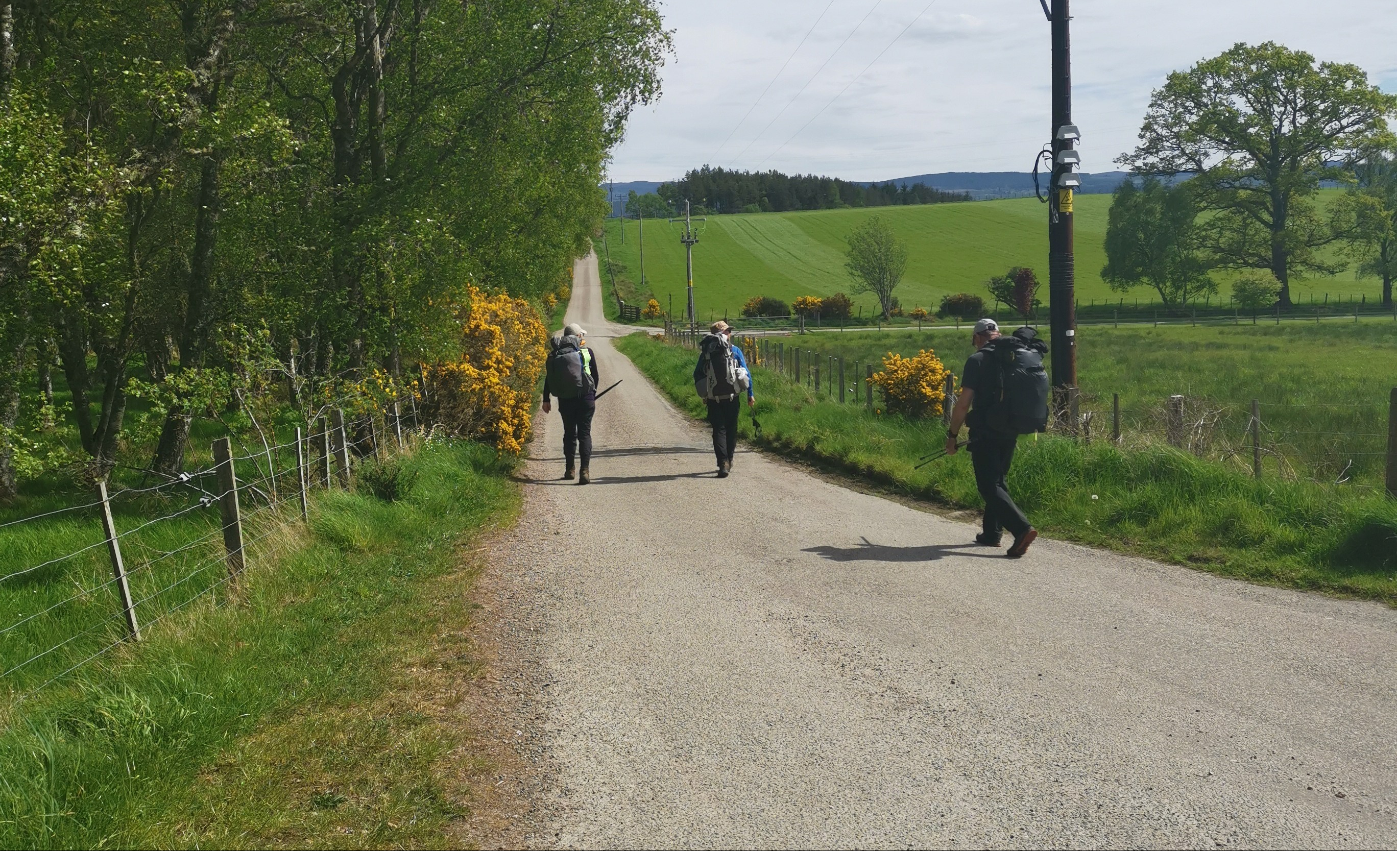
On The Great Glen Way heading for Inverness.  

2019-05-14 11.23.34
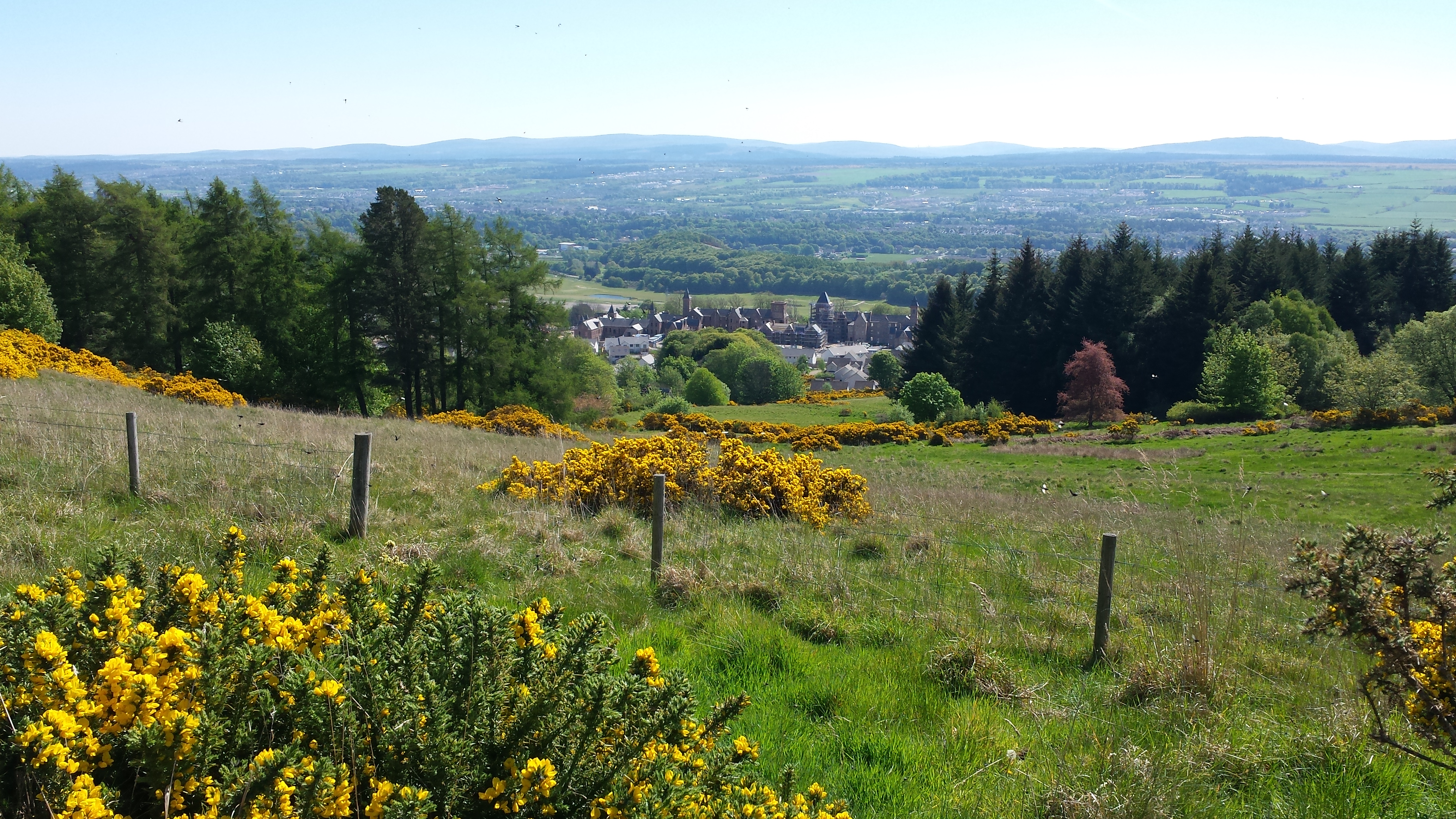
Inverness looms before us. The mock-baronial apartment complex in the centre.

The forested part of the Great Glen Way is bliss. Parts of it are like walking in the garden of a stately home, with tunnelled canopies of trees – very welcome as the temperature begins to soar. As we descend and the city appears below us, we see what looks like a castle. As we get closer, it appears to be a massive renovation. Closer still, it becomes apparent it’s neither: this is a hugely expensive, mock baronial apartment complex with what appears to be a renovated kirk in the middle. Eventually, we emerge onto the Caledonian Canal where we pause for a while before continuing across the River Ness’s islands and parks. For anyone into river kayaking, this is paradise.

2019-05-14 12.14.10

2019-05-14 13.19.43

2019-05-14 13.25.30
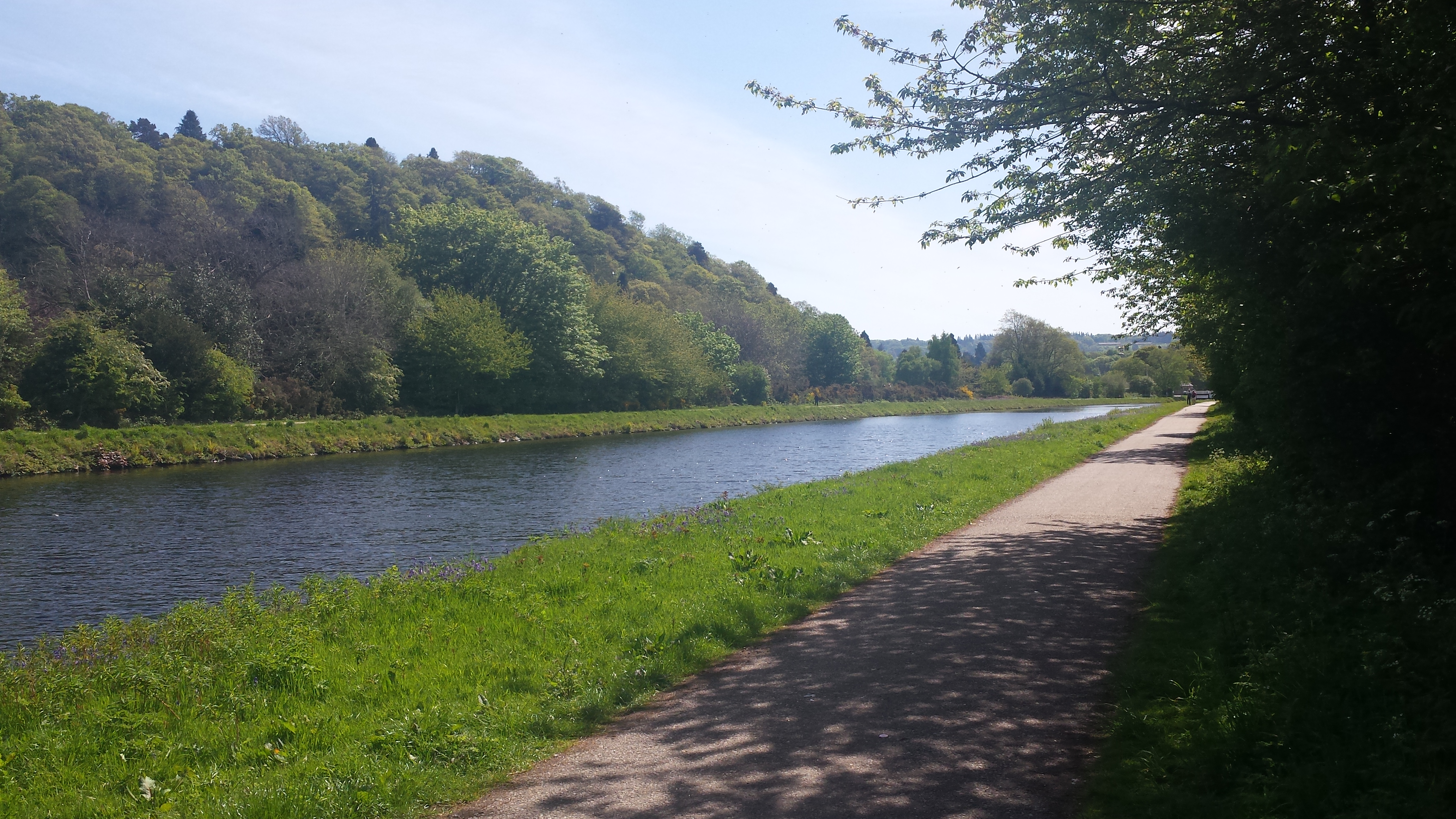
The Caledonian Canal. The river Ness and a take on Nessie from a fallen tree in the park.

Our next section is a complete contrast and sadly, unavoidable. We walk through the built-up areas of Lower Drummond and Hilton, south of the city. Let’s just say, and with no offence intended, it’s an area where you wouldn’t want to dally. We come out the other side and head towards General Wade’s military road. Sometimes you just have to down packs in the most unlikely places. Pausing on the grass verge of a busy roundabout, we sunbathed, watched the passersby and almost fell asleep, oblivious to the traffic noise. Our stomachs were beginning to rumble…

We need food and water! Spotting a sign for a nearby hotel, we head in that direction, only to find out from a passerby that it has closed. Frustrated, particularly as we had ignored the opportunity to walk to the local Co-op from a roundabout earlier, we trudge on along a forest path. Come in Trail Angel number two. A man with a shopping bag appears, who – you guessed it – is going to the Co-op. He gives us directions and trots off to the store, where we catch up with him soon after. Sheltering from the sun in the shade of the trolley shelter, we devour our purchases, much to the amusement of the locals. Never has so much food and drink been consumed in such a short time. Walking back, I manage to snap this of Heather and Tim. The TGO is not all about wild places and forests.

2019-05-14 12.40.22

Retracing our steps, we continue on General Wade’s road through beautiful forests to Dundavie. After crossing the busy A9 and over the River Nairn, after a final 2 kilometres of road walking, we see a very welcome sign: Auchnahillin Holiday Park. A long, hot day comes to an end with thoughts of a shower and rest.

2019-05-15 08.36.38Auchnahillin Holiday Park campsite. 

Distance: 27km
Time: 9hrs 22mins
Total ascent: 560m
Max elevation: 354m


Wednesday 15 May
Auchnahillin to Insharn

More sunshine – is this really Scotland? A beautifully crisp morning greats us again. Today we walk to Insharn, a regularly used challenge stop on Wade’s road. This is one of those days where the tarmac is unavoidable. After discussion, we agree to bypass a little of it by detouring into the Moy Estate and the loch of the same name.

Turning left from the campsite, we walk for about 2 kilometres to the Moy Estate, famous for its grouse shooting. Not something I agree with in any way. Once past the main estate buildings and the splendid Moy Hall, Tim has an encounter with a goat, who seems very interested in the possibility of free food. We emerge onto the high path on the east side, or top edge, of Loch Moy. It makes a picture-postcard vista, and halfway along we stop to rest and soak up the stunning view over the Isle of Moy.

2019-05-15 10.56.25

2019-05-15 11.48.42A friendly white goat. Loch Moy and the Isle of Moy where the remains of the original laird’s house still stand.

Leaving Loch Moy, we retrace our route through the forest, crossing Dalmacgarry burn back to cross the main road again onto cycle route 7. Easy walking here albeit on the tarmac, we head for Tomatin, and spotting a beer jug symbol on the map look forward to some refreshment.

Tomatin’s famous distillery, which we passed on the way here, with some reluctance, seems to be thriving and, I imagine, is the main source of local employment. We pass under the spectacular rail bridge, turning right onto the main street. It’s a very hot day and we need to stop soon.

The village has a community shop and post office. We are in luck as the shelves are well stocked. Asking where the pub is, we are told it has gone. There is a pattern forming here. So many of the pubs and hotels have closed or simply vanished. This is sad as most used to be where people met and socialised, particularly in remote villages.

Heather, the brave and cheeky one of the group, asks if we can move the picnic table outside out of the sun. We fill our faces with soft drinks, sandwiches, crisps, ice cream and even burgers microwaved in the store. After refilling our water bottles, we head off. It’s great to see a thriving enterprise like this. We need more stores supported and run by the people that use them.

I had been told about the three bridges in Tomatin. We arrive at the first, the Findhorn road bridge. Built in 1926 by engineer Sir Owen Williams, with help from the architect Maxwell Ayrton, it is one of a series along the A9. This is probably the most striking. A little OTT but splendid nevertheless, it replaced a bridge built by Thomas Telford dating from 1833. The photo shows the three bridges from one of the pedestrian refuge arches.

2019-05-15 17.29.01-1

fznor_vivid
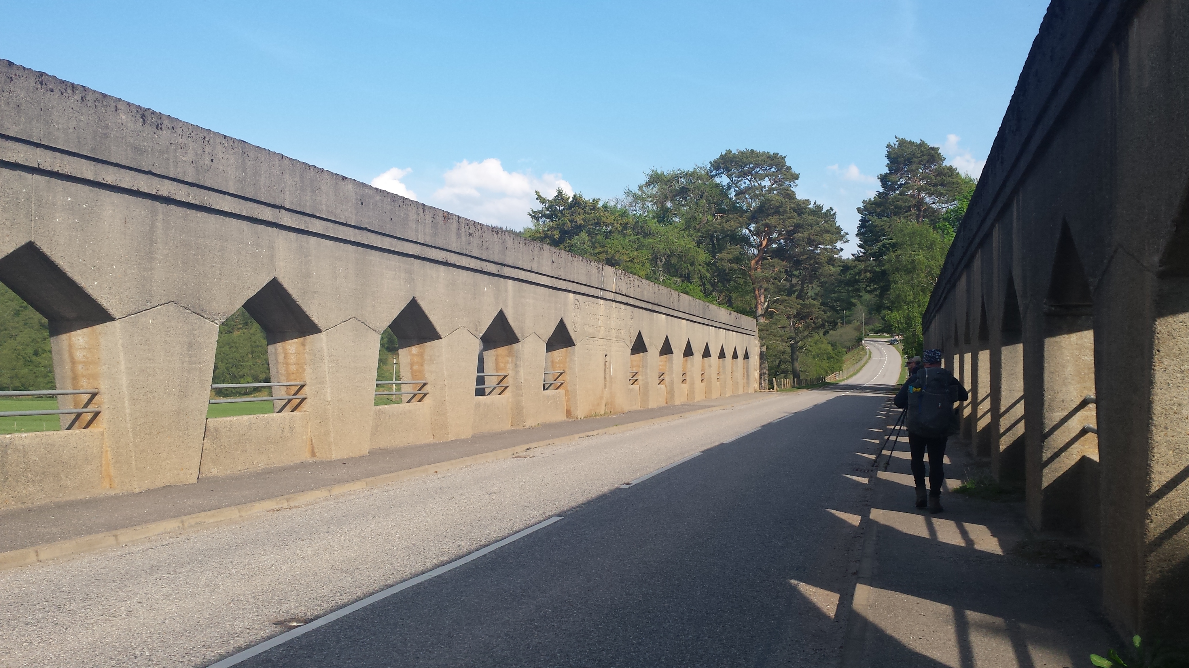
The three Findhorn bridges.  The Owen Williams bridge in the foreground. The railway and new A9 road bridges in the distance.  Arch photo: Dave Glenn Hewitt

Picking up cycle route 7 again, which runs parallel to the A9, we climb to arrive at Slochd Summit at 400m, and finally, the sign as we enter Cairngorms National Park. There is an instant and dramatic change in the scenery as we cross the invisible border.

2019-05-15 18.33.02

2019-05-15 18.45.39

2019-05-15 18.47.09Entering the Cairngorms National Park

We arrive shattered at Incharn, mainly due to the heat of the day, which no matter how hydrated you are and how well fed, takes its toll. After a cooling walk along a forest track, we turn into an open field, the barking of dogs on the nearby farm announcing our arrival. A few minutes after we set up, a lone walker appears. It’s Andy Bailey, a fellow Backpacking Club member. He had planned to join us for a few days but we weren’t sure where. He will walk with us to the Fords of Avon, before heading off to Braemar and home.

Distance: 24.6km
Time: 8hrs 48mins
Total ascent: 697m
Max elevation: 409m

TGO 2019 – Off we go…

It’s taken a few months of planning – well, six to be exact, but here I am ready to go.

There have been lots of changes to gear and the way I have packed, with many lessons learned from my TGO18 crossing. It’s not the lightest I’m sure, but a lower base weight and overall average pack weight than before.

Heaviest pack: 22lb (9.9kg) on the first day with 5 days’ food, water and fuel
Base weight: 15.5lb (7kg)
Average full pack: 17lb (7.7kg) with 1.5kg of consumables.

2019-05-08 Everything
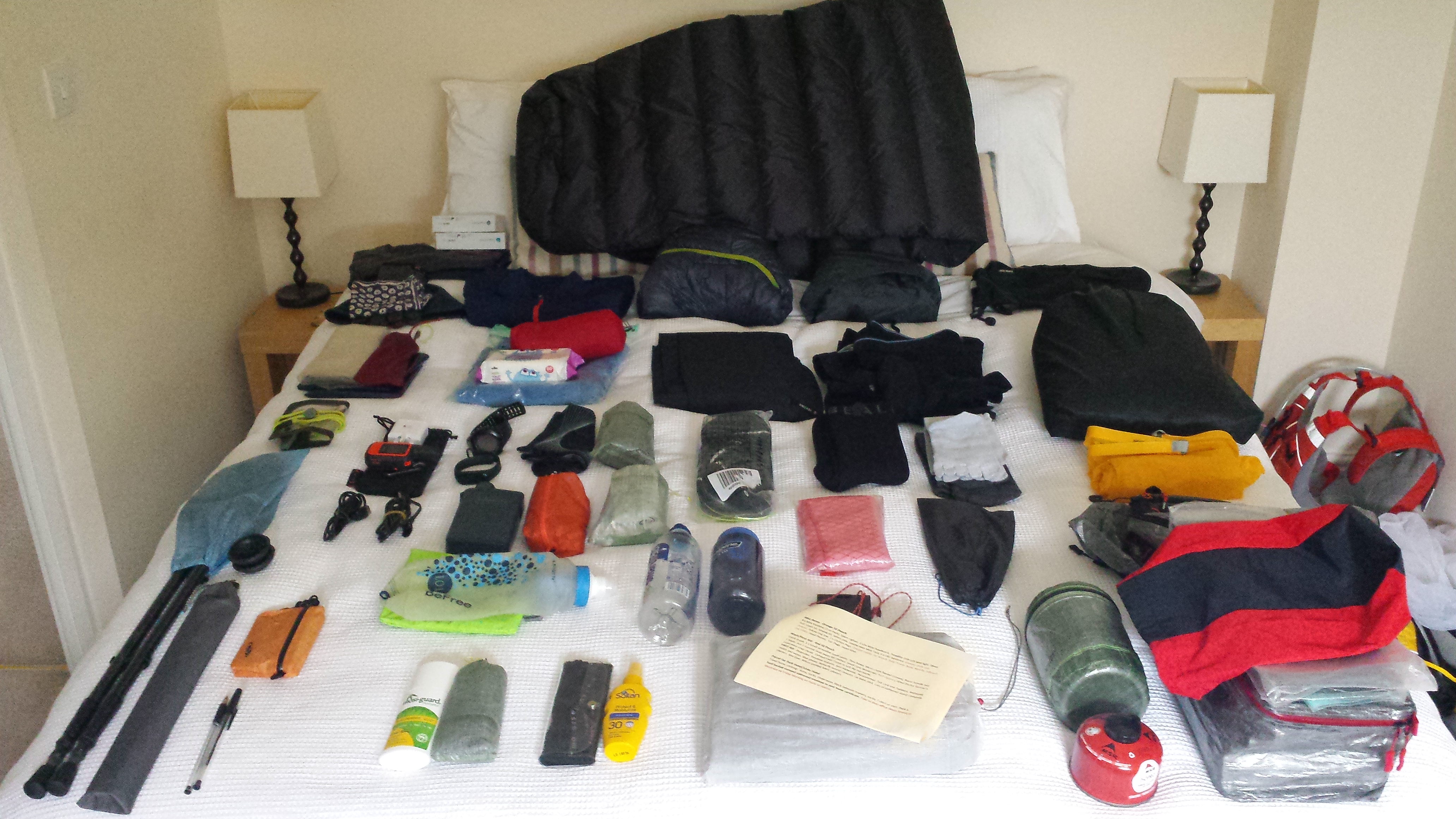
There were a couple of items that didn’t get into the bag.

2019-05-08 Pods.jpgTread Lite Gear Cuben pods for food, clothing, misc items and stove – brilliant!

Using the excellent Treadlite Gear pods and covers, packing has become so easy with everything in its place and, more importantly, where I can find it. I have been lucky to have been sent a sample Silverback 2019 55ltr rucksack from Gossamer Gear to play with on the crossing. Many thanks to Grant and Ken for that – a review will follow soon.

As I have feet like a hobbit, I have chosen Altra Lone Peak 4 trail shoes this year, which was a big decision. I have walked about 50 miles in them and not a hot spot or blister – unlike with boots last year when my toes and feet were trashed! Trail shoes are lighter, dry really quick and allow the toes to spread and move as they were designed to. The ‘boot-trail shoe’ debate will rumble on I know, but this is my choice this year.

2019-05-08 Rucksack and ShoesGossamer Gear Silverback 55 all packed and Altra Lone Peak 4, ready to go.

Also, this year, I have been invited to take part in Ed Hyatt’s Whither Wilderness research project for Northumbria University. It’s a study of information and technology use on the TGO, which is quite exciting and means I get to play with lots of gadgets, which I’ll report on too.

Gone to the beach

2016-10-30-12-20-45

Heading towards Gullane – and lunch

Walking along the beach from North Berwick to Gullane, I felt as if I’d left something behind. When you’re used to walking with a rucksack, albeit a light one, it can feel strange to be without.

The East Lothian coast, with its rocky islands and ruined castles, makes an enjoyable and relatively undemanding change of scene from my usual haunts in the Lakeland fells.

2016-10-30-12-20-40

Looking back to Fidra, with its lighthouse

2016-10-30-13-15-34

The forested dunes at Jamie’s Neuk

Even though we walked only 6.5 miles, we felt fully entitled to a Sunday lunch of wiener schnitzel with a fried egg on top, buttery mashed potato and a beer, followed by strong coffee and a shared nut tart at the German bakery, Falko.

2016-09-04-13-54-47

Falko on Gullane Main Street

We then compounded matters by returning to North Berwick and our lovely holiday cottage, rented from the superb gonetothebeach.co.uk, on the bus. But everyone deserves a rest now and again, don’t they?

It all started with polar blanky

Morning after with polar blanky

My introduction to fast and light wild camping was courtesy of two friends who invited me along one sunny January afternoon. There’s a clue there if you look: January. These guys had done this before but I hadn’t. I’d cycle and car camped for many years – entirely different – and my kit reflected my experience, as did theirs.

I realised it would be a cold night in the fells and looked around for the warmest gear in my limited collection. At the time, I had only a 2-degree Vango summer sleeping bag and thin ThermaRest mat. Not a good start. Then I found ‘polar blanky’. Yes, this really was a cuddly blanket decorated with polar bears – a free gift from Damart to my aged mother, one of their ‘best’ customers (or so they told her). It was a light, synthetic fleece material and proved a warm and, probably, lifesaving addition to my kit.

We woke up to tents crisp with thick frost, at what we later found out was minus 8 degrees. The tarn we were next to had frozen over and, as I had kept my lack of appropriate kit from them the night before, when they saw what I’d brought, they were astonished I was still alive. To this day, it is still talked of as the ‘polar blanky’ trip.

Thankfully, both my kit and experience have increased greatly since then but, as a badge of honour, I still have the blanket!

Building your kit, for any sport or pastime, is quite a journey, emotionally and financially. I’ve come to realise it takes time, involves mistakes, expense, disasters, light-bulb moments, reality checks, occasionally being in the dog-house, constant indecision and even the odd sleepless night.

It seems to be a process that never quite finishes, partly because manufacturers, like software companies, are always revising and upgrading their products, teasing us with something shinier, sleeker and smaller that does exactly the same as your old one but at half the weight and twice the price. Then there are the ‘trends’, which come and go with increasing regularity as wheels are re-invented.

Those of us with slightly less experience, not to mention will-power, can have a torrid time ignoring those skilful marketeers and nailing down what really works for us.

The transformation from a ‘camper’, who is just out for fun with the family, into a demented, list-making ‘gram weenie’ can be all-consuming. What I and many others who spend quality time in the outdoors have realised is that it becomes a very personal process and, because it’s personal, it can, if not checked, become obsessive.

I thought it might be useful to share my current winter backpacking list. I’ve been building up this gear for a couple of years, swapping old for new, heavier for lighter, and lighter for even lighter. I could, of course, just go into a store or online and buy all my lightweight kit in one go and be done with it. But we all know that’s not how it works.  As I said, there will always be better, lighter and smaller, just around the corner.

Winter backpacking list

Most readers who backpack will recognise things they use themselves. Perhaps there’s the odd item that interests you, some you may even laugh at, and one or two that are a surprise – hopefully, in a ‘why didn’t I think of that’ kind of way. Some items double as something else, some have multiple uses and some are there, well, just because.

This is a two-night backpacking gear list with a base weight of 13.5 lbs. It’s not meant to be an ultralight list for adventure racing, and in my next post, I’ll explain my reasons for including some of the items in my bag – and why it’s vital to have a list (even if you’re not a ‘list person’).

Tents I have known and, sometimes, loved

Wild camping with the Soulo

Hopefully, my last post got you thinking about the tents you’ve known and loved – or hated – over the years. It certainly did that to me. At least, the ones I can remember. So here goes…

Try reading the following to the tune of the Twelve Days of Christmas:

  • A Marechal two-person 17lb heavyweight – my first tent;
  • Numerous dome tents from the cheaper outlets, some so damaged they were left at the festivals where they stood;
  • A Wynnster four-berth family tent, made memorable by my youngest throwing up in it, missing her mother’s face by millimetres;
  • Four Vango tents of various sizes and styles including the iconic Banshee and Blade – all brilliant for those on a small budget;
  • Three Hillebergs – Nallo, Akto and Soulo (pictured above) – all superior design and quality and crazy expensive unless you’re in a position not to care about budget;
  • Numerous homemade tarps, most never used;
  • Several shop bought tarps including Go-Lite and DD;
  • A Wild Country Zephyros 1 – a very popular backpacker’s tent but too narrow for me;
  • A Luxe Hex Peak – a simple, roomy tepee tent with half-mesh inner;
  • A Trekkertent Stealth 1 with both a solid and (my next purchase) full mesh inner for midge-free summer evenings.

(Yes, I know the tune doesn’t quite work.)

From that collection, spread over many years, only four remain: the ancient Hilleberg Nallo 3GT, the Hilleberg Soulo, the Luxe Hex Peak and, my latest, the Trekkertent Stealth 1.

And my reasons for keeping these?

The Hillebergs speak for themselves. They are not cheap, and even though we all know more money does not always equal more tent, in this case it does. There’s a reason why Artic expeditions use Hillebergs, and at a recent Backpackers’ Club meet, six out of nine tents were Aktos.

Hillebergs are beautifully made, well researched with rugged Kerlon fabrics and will protect you in the foulest and coldest conditions. When I first used an Akto, my lack of experience led me to feel it was too small for my needs. Now, it would probably seem like a palace!

The only problem I’ve found, as many others have too, is Hilleberg’s overall packed weight. This probably doesn’t apply to their more recent Enan solo tent, at a packed weight of 1.1 kilos.

When I use the outer of the Soulo in the summer as a single skin, with poles, pegs and footprint, it’s still not a light option, at 1.8 kilos. Adding the inner for winter use brings it to 2.4 kilos. For this reason, I carry the Soulo only when it’s a short walk in and overnight pitch or, when I’m prepared to carry the extra weight, above the snowline.

The trusty Nallo was once the go-to shelter for the cycle tourer and backpacker. We bought the bigger 3GT (that’s a three-person version with a porch) back in 2000. Originally for tandem touring, we now use it mainly for car camping or backpacking, where we can split the weight to about 1.7 kilos each.

Even at a packed weight of 3.4 kilos, it’s a manageable and palatial tunnel shelter, which goes up in a few minutes and has withstood three-day gales and biblical rain storms.

In 2014, I bought the Luxe Hex Peak, a very simple tepee, six-sided design that uses a walking pole for the centre support. I can see why this style is very popular in Scandinavia. Unfortunately, I don’t have the strength to carry the obligatory wood burner!

The Luxe Hex Peak in high wind

The Luxe Hex Peak in high wind

A simple, but certainly not a new concept, the Hex also goes up in a few minutes, is roomy and, with the exception of gale force winds, will withstand most UK weather.

The fly can be pitched flush to the ground in foul weather, or high off the ground using a walking pole extender, in warmer conditions. The inner, which is half mesh, can be set up on its own for summer use. But the mesh can make this tent a little too draughty in winter and, because of this, I would class it as a thee-season option.

As I’m always looking to cover greater distances, I was keen to reduce the weight of the big three – tent, rucksack and sleeping bag. Rucksack at 800g and down sleeping bag at 900g are acceptable for the moment, so that only leaves the tent. (I’ll be writing about rucksacks and sleep systems in future posts.)

In January, after much research, I bought a Trekkertent Stealth 1. I’d read reviews by other bloggers (Section Hiker and Overthehills) whose comprehensive descriptions persuaded me to plump for it. It’s also good to support one of a few UK tent makers.

My version of the Stealth weighs 780g, which now includes eight titanium nail pegs and a short folding pole for the rear, as I use both my trekking poles to support the front. As for other uses, it can be a winged tarp, pitched low to cover a bivvy bag. The solid inner can be used on its own in the summer, and the mesh inner combined with a poncho tarp for a midge-free night under the stars.

Like many backpackers, trekkers and wild campers, I’ve spent the last few years looking for the perfect shelter. But what I’ve come to realise it that it’s a never-ending quest. Your perfect tent won’t necessarily be mine – and, in the end, one will never be enough. But isn’t that part of the journey?